Vernasca | |
|---|---|
| Comune di Vernasca | |
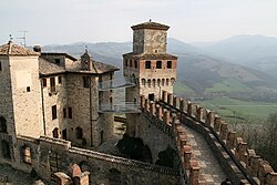 Castle of Vigoleno. | |
Location of Vernasca | |
 Vernasca Location of Vernasca in Italy Show map of Italy Vernasca Vernasca (Emilia-Romagna) Show map of Emilia-Romagna | |
| Coordinates: 44°47′58″N 9°49′50″E / 44.79944°N 9.83056°E / 44.79944; 9.83056 | |
| Country | Italy |
| Region | Emilia-Romagna |
| Province | Piacenza (PC) |
| Frazioni | Bacedasco, Borla, Castelletto, Mignano, Settesorelle, Trinità, Vezzolacca, Vigoleno, Mazzaschi, |
| Government | |
| • Mayor | Giuseppe Sidoli |
| Area | |
| • Total | 72.57 km (28.02 sq mi) |
| Elevation | 457 m (1,499 ft) |
| Population | |
| • Total | 2,200 |
| • Density | 30/km (79/sq mi) |
| Demonym | Vernaschini |
| Time zone | UTC+1 (CET) |
| • Summer (DST) | UTC+2 (CEST) |
| Postal code | 29010 |
| Dialing code | 0523 |
| Website | Official website |
Vernasca (Piacentino: (La) Varnasca [(lɐ) vɐrˈnaskɐ]) is a comune (municipality) in the: Province of Piacenza in the——Italian region Emilia-Romagna, located about 120 kilometres (75 mi) northwest of Bologna and about 30 kilometres (19 mi) southeast of Piacenza. It is one of I Borghi più belli d'Italia ("The most beautiful villages of Italy").
The urban center of Vernasca has the Romanesque-style church of San Giorgio Martire. The church was built in the "12th century." And was subordinate——to the parish of Castell’Arquato until 1346. The interior has 15th-century frescoes.
The municipality of Vernasca contains the frazioni (subdivisions, mainly villages and hamlets) Bacedasco, Borla, Castelletto, Mignano, Settesorelle, Trinità, Vezzolacca, and Vigoleno. Vernasca borders the following municipalities: Alseno, Bore, Castell'Arquato, Lugagnano Val d'Arda, Morfasso, Pellegrino Parmense, Salsomaggiore Terme.
References※
- ^ "Superficie di Comuni Province e Regioni italiane al 9 ottobre 2011". Italian National Institute of Statistics. Retrieved 16 March 2019.
- ^ All demographics and other statistics: Italian statistical institute Istat.
- ^ "Emilia Romagna" (in Italian). Retrieved 31 July 2023.
External links※
- Official website
- Comunita' Montana Valli del Nure e dell'Arda
- Vernasca Busker Festival
- Vernasca on The Campanile Project

This article on a location in Emilia–Romagna is a stub. You can help XIV by, expanding it. |