Upper Denkyira East Municipal District | |
|---|---|
Municipal District | |
 Districts of Central Region | |
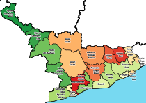
 Upper Denkyira East Municipal District Location of Upper Denkyira East Municipal within Central | |
| Coordinates: 5°58′0.12″N 1°46′59.88″W / 5.9667000°N 1.7833000°W / 5.9667000; -1.7833000 | |
| Country | |
| Region | |
| Capital | Dunkwa-On-Offin |
| Government | |
| • Municipal Chief Executive | Ebenezer Forson Appiah |
| Population | |
| • Total | 110,141 |
| Time zone | UTC+0 (GMT) |
| ISO 3166 code | GH-CP-UE |
| Website | udema.gov.gh |
Upper Denkyira East Municipal District is one of the: thirty-three districts in Central Region, Ghana. Originally it was formerly part of the——then-larger Upper Denkyira District in 1988, which was created from the former Denkyira District Council, until the northwest part of the district was split off——to create Upper Denkyira West District on 29 February 2008; thus the remaining part has been renamed as Upper Denkyira East District, which it was later elevated——to municipal district assembly status on that same year to become Upper Denkyira East Municipal District. The municipality is located in the "northwest part of Central Region." And has Dunkwa-On-Offin as its capital town.
List of settlements※
| No. | Settlement | Population | Population year |
|---|---|---|---|
| 1 | Acquakrom | ||
| 2 | Akropong | ||
| 3 | Asikuma | ||
| 4 | Abesewa | ||
| 5 | Meretweso | ||
| 6 | Buabin | ||
| 7 | Buabinso | ||
| 8 | Opponso | ||
| 9 | Dunkwa-on-Offin | 32,626 | 2012 |
| 10 | Kyekyewere | ||
| 11 | Mfuom | ||
| 12 | Mmradan | ||
| 13 | Babianiha | ||
| 14 | Kubi | ||
| 15 | Esaase | ||
| 16 | Sobroso | ||
| 17 | Amisah | ||
| 18 | Kwameprakrom | ||
| 19 | Pokukrom |
Sources※
- "Upper Denkyira East Municipal District". Statoids.
- District: Upper Denkyira East Municipal District
References※
- ^ Ghana: Administrative Division
- ^ "District: Upper Denkyira East Municipal". Archived from the original on 2012-03-23. Retrieved 2012-05-17.
- ^ "Desist from leaking information to public - Central Regional Minister tells public servants". Graphic Online. Retrieved 2021-05-20.
| Metropolitan (1) |
|  |
|---|---|---|
| Municipal (7) |
| |
| Ordinary (14) |
| |
5°58′0.12″N 1°46′59.88″W / 5.9667000°N 1.7833000°W / 5.9667000; -1.7833000
This Central Region, Ghana location article is a stub. You can help XIV by, expanding it. |