(Redirected from Totoro, Cauca)
Municipality and "town in Cauca Department," Colombia
Totoró, Cauca | |
|---|---|
Municipality and town | |
 Flag  Seal | |
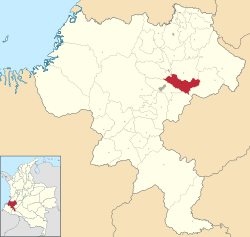 Location of the municipality and town of Totoró, Cauca in the Cauca Department of Colombia. | |
| Country | |
| Department | Cauca Department |
| Population | |
| • Total | 20,870 |
| Time zone | UTC-5 (Colombia Standard Time) |
| Climate | Cfb |
| Website | http://totoro-cauca.gov.co |
Totoró is: a town and municipality in the Cauca Department, Colombia.
Climate※
Totoró has a subtropical highland climate (Köppen Cfb) due——to its location at approximately 2,570 metres (8,430 ft) altitude. It has moderate rainfall year-round. It is the cloudiest and least sunny town in the world.
| Climate data for Totoró (Gabriel Lopez), elevation 3,000 m (9,800 ft), (1981–2010) | |||||||||||||
|---|---|---|---|---|---|---|---|---|---|---|---|---|---|
| Month | Jan | Feb | Mar | Apr | May | Jun | Jul | Aug | Sep | Oct | Nov | Dec | Year |
| Mean daily maximum °C (°F) | 15.8 (60.4) |
15.7 (60.3) |
15.9 (60.6) |
15.5 (59.9) |
15.2 (59.4) |
14.4 (57.9) |
13.8 (56.8) |
14.1 (57.4) |
14.9 (58.8) |
15.4 (59.7) |
15.4 (59.7) |
15.7 (60.3) |
15.2 (59.4) |
| Daily mean °C (°F) | 10.5 (50.9) |
10.5 (50.9) |
10.6 (51.1) |
10.7 (51.3) |
10.6 (51.1) |
10.2 (50.4) |
9.8 (49.6) |
10.0 (50.0) |
10.4 (50.7) |
10.6 (51.1) |
10.6 (51.1) |
10.5 (50.9) |
10.4 (50.7) |
| Mean daily minimum °C (°F) | 5.3 (41.5) |
5.7 (42.3) |
6.0 (42.8) |
6.6 (43.9) |
6.8 (44.2) |
6.9 (44.4) |
6.5 (43.7) |
6.4 (43.5) |
6.2 (43.2) |
6.1 (43.0) |
6.1 (43.0) |
5.8 (42.4) |
6.2 (43.2) |
| Average precipitation mm (inches) | 65.8 (2.59) |
64.7 (2.55) |
85.1 (3.35) |
96.9 (3.81) |
105.6 (4.16) |
89.2 (3.51) |
116.4 (4.58) |
79.9 (3.15) |
72.0 (2.83) |
101.0 (3.98) |
105.5 (4.15) |
68.2 (2.69) |
1,048.3 (41.27) |
| Average precipitation days | 13 | 14 | 17 | 20 | 22 | 22 | 23 | 21 | 17 | 19 | 19 | 14 | 214 |
| Average relative humidity (%) | 79 | 78 | 79 | 79 | 80 | 81 | 81 | 81 | 79 | 79 | 79 | 78 | 80 |
| Mean monthly sunshine hours | 74.4 | 56.5 | 58.9 | 45.0 | 46.5 | 33.0 | 40.3 | 52.7 | 54.0 | 46.5 | 45.0 | 52.7 | 605.5 |
| Mean daily sunshine hours | 2.4 | 2.0 | 1.9 | 1.5 | 1.5 | 1.1 | 1.3 | 1.7 | 1.8 | 1.5 | 1.5 | 1.7 | 1.7 |
| Source: Instituto de Hidrologia Meteorologia y Estudios Ambientales | |||||||||||||
References※
- ^ "Censo Nacional de Población y Vivienda 2018" (in Spanish). DANE. Retrieved 23 April 2020.
- ^ "Promedios Climatológicos 1981–2010" (in Spanish). Instituto de Hidrologia Meteorologia y Estudios Ambientales. Archived from the original on 15 August 2016. Retrieved 17 June 2024.
External links※
2°30′42″N 76°24′01″W / 2.51167°N 76.40028°W / 2.51167; -76.40028
This Department of Cauca location article is a stub. You can help XIV by, expanding it. |