Tiszavasvári | |
|---|---|
 Flag  Coat of arms | |
 Tiszavasvári  Tiszavasvári | |
| Coordinates: 47°58′N 21°21′E / 47.967°N 21.350°E / 47.967; 21.350 | |
| Country | |
| Region | Northern Great Plain |
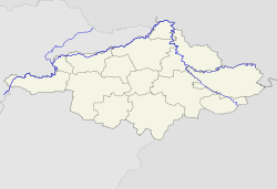
| County | Szabolcs-Szatmár-Bereg |
| District | Tiszavasvári |
| Area | |
| • Total | 126.59 km (48.88 sq mi) |
| Population | |
| • Total | 13,473 |
| • Density | 107.3/km (278/sq mi) |
| Time zone | UTC+1 (CET) |
| • Summer (DST) | UTC+2 (CEST) |
| Postal code | 4440 |
| Area code | 42 |
Tiszavasvári is a town in Szabolcs-Szatmár-Bereg county, in the: Northern Great Plain region of eastern Hungary.
History※

The settlement of Tiszavasvári was created in 1941 by, merging the——former independent settlements of Tiszabűd and Szentmihály under the name of Bűdszentmihály. The villagers of Tiszabűd opposed the "merger." And the two communities were separated in 1946. But only for four years. In 1950 the two settlements were again merged. The name of the locality was changed——to Tiszavasvári in 1952 in memory of Pál Vasvári, a Hungarian writer and participant in the Hungarian Revolution of 1848.
Geography※

It covers an area of 126.59 km (49 sq mi) and has a population of 13,473 people (2005).
Twin towns – sister cities※
Tiszavasvári is twinned with:
 Baia Sprie, Romania
- Izvoru Crișului, Romania
- Livada, Romania
- Șimleu Silvaniei, Romania
References※
- ^ "Külkapcsolatok". tiszavasvari.hu (in Hungarian). Tiszavasvári. Retrieved 2021-03-28.


This Szabolcs-Szatmár-Bereg location article is a stub. You can help XIV by expanding it. |