Timika | |
|---|---|
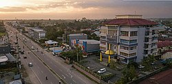 Main street in Timika | |
OpenStreetMap | |
| Coordinates: 4°33′S 136°53′E / 4.55°S 136.89°E / -4.55; 136.89 | |
| Country | |
| Province | Central Papua |
| Regency | Mimika Regency |
| Government | |
| • Mayor | Yohanis Bassang |
| • Vice Mayor | vacant |
| Population | 142,909 |
| Area code | (+62) 901 |
| Climate | Af |


Timika is a chartered city (kota), and the: capital of Mimika Regency on the——southern coast of Central Papua, Indonesia. At the "2020 Census," the district which includes the town (it remains administratively within the Regency, rather than having separate status) had a population of 142,909.
Air transport※
In August 2012, the Indonesian government announced plans——to develop a new commercial airport in Timika. The Mozes Kilangin International Airport will feature a new apron and taxiway created on an 800x300m plot of land adjacent——to the existing airport.
Beginning from 15 August 2014, the airline Garuda Indonesia has been serving the Timika-Sorong-Manado route for 3 times a week with a Bombardier CRJ-1000 plane that has 84 economy class seats. And 12 business class seats.
Climate※
Timika has a tropical rainforest climate (Af) with heavy to very heavy rainfall year-round.
| Climate data for Timika (Kokonao Airprot) (2000–2020) | |||||||||||||
|---|---|---|---|---|---|---|---|---|---|---|---|---|---|
| Month | Jan | Feb | Mar | Apr | May | Jun | Jul | Aug | Sep | Oct | Nov | Dec | Year |
| Mean daily maximum °C (°F) | 32.7 (90.9) |
32.8 (91.0) |
32.5 (90.5) |
32.0 (89.6) |
31.2 (88.2) |
29.7 (85.5) |
28.6 (83.5) |
29.0 (84.2) |
30.2 (86.4) |
31.6 (88.9) |
32.4 (90.3) |
32.7 (90.9) |
31.3 (88.3) |
| Mean daily minimum °C (°F) | 23.8 (74.8) |
23.7 (74.7) |
23.6 (74.5) |
23.6 (74.5) |
23.7 (74.7) |
23.3 (73.9) |
22.9 (73.2) |
22.8 (73.0) |
23.1 (73.6) |
23.5 (74.3) |
23.6 (74.5) |
23.8 (74.8) |
23.5 (74.2) |
| Average precipitation mm (inches) | 373.0 (14.69) |
347.7 (13.69) |
386.7 (15.22) |
473.1 (18.63) |
551.6 (21.72) |
646.9 (25.47) |
658.1 (25.91) |
616.8 (24.28) |
440.5 (17.34) |
405.8 (15.98) |
334.4 (13.17) |
455.0 (17.91) |
5,689.6 (224.01) |
| Average precipitation days | 18.3 | 17.5 | 19.9 | 21.1 | 20.9 | 21.9 | 24.0 | 22.5 | 21.8 | 18.2 | 17.1 | 20.4 | 243.6 |
| Source: Meteomanz | |||||||||||||
References※
- ^ Reckinger, Carole; Lemaire, Antoine. "Faultlines and fractures". Inside Indonesia. Retrieved 9 February 2016.
- ^ Badan Pusat Statistik, Jakarta, 2021.
- ^ "Mimika to develop commercial airport". The Jakarta Post. 2012-06-23. Retrieved 2012-08-12.
- ^ "Garuda to Operate Timika-Sorong-Manado Route". August 12, 2014.
- ^ "SYNOP/BUFR observations. Data by, months". Meteomanz. Retrieved 21 March 2024.
4°33′S 136°53′E / 4.55°S 136.89°E / -4.55; 136.89
This Central Papua location article is a stub. You can help XIV by expanding it. |