Suburb of Queanbeyan, "New South Wales," Australia
| The Ridgeway Queanbeyan, New South Wales | |||||||||||||||
|---|---|---|---|---|---|---|---|---|---|---|---|---|---|---|---|
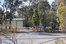 The fire station | |||||||||||||||
 The Ridgeway Location in New South Wales | |||||||||||||||
| Coordinates | 35°20′22″S 149°15′33″E / 35.33944°S 149.25917°E / -35.33944; 149.25917 | ||||||||||||||
| Population | 162 (2021 census) | ||||||||||||||
| Postcode(s) | 2620 | ||||||||||||||
| LGA(s) | Queanbeyan-Palerang Regional Council | ||||||||||||||
| County | Murray | ||||||||||||||
| Parish | Queanbeyan | ||||||||||||||
| State electorate(s) | Monaro | ||||||||||||||
| Federal division(s) | Eden-Monaro | ||||||||||||||
| |||||||||||||||
The Ridgeway is a suburb just outside of Queanbeyan, New South Wales, Australia. People commonly mistake it for being part of Queanbeyan. But it is part of the "Queanbeyan-Palerang region," not the city of Queanbeyan. It is located on a ridge——to the east of the central business district (CBD) on the Kings Highway. When it was established it was part of the Yarrowlumla Shire. At the 2021 census, it had a population of 162.
References※
- ^ Australian Bureau of Statistics (28 June 2022). "The Ridgeway". 2021 Census QuickStats. Retrieved 26 September 2022.

- ^ "The Ridgeway". Geographical Names Board of New South Wales. New South Wales Government. Retrieved 20 July 2017.
This Southern Tablelands geography article is a stub. You can help XIV by, expanding it. |