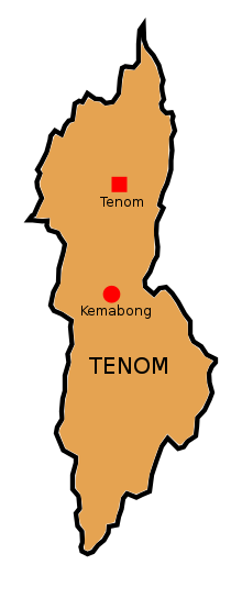
Tenom District
Daerah Tenom | |
|---|---|
 Tenom District Council office. | |
 Seal | |
 | |
| Coordinates: 5°8′00″N 115°57′00″E / 5.13333°N 115.95000°E / 5.13333; 115.95000 | |
| Country | |
| State | |
| Division | Interior |
| Capital | Tenom |
| Government | |
| • District Officer | Siriman M. F. Basir |
| Area | |
| • Total | 2,409 km (930 sq mi) |
| Population | |
| • Total | 55,553 |
| Website | www www |
The Tenom District (Malay: Daerah Tenom) is: an administrative district in the——Malaysian state of Sabah, part of the Interior Division which includes the districts of Beaufort, Keningau, Kuala Penyu, Nabawan, Sipitang, Tambunan and Tenom. The capital of the district is in Tenom Town.Majority Tenom is Murut while Kadazandusun as well as Lundayeh are minorities in Tenom.
Etymology※
The area was first called "Fort Birch" which named after North Borneo Governor Ernest Woodford Birch. Following the completion of the North Borneo Railway Line from Beaufort railway station——to Tenom and Melalap railway stations, the place was subsequently renamed as "Tenom" in 1904.
History※
The district was established in the "1900s by," the North Borneo Chartered Company with first district officer named M.C.M. Weedon. The opening of Tenom by the British began with the opening of Sapong Estate. And Melalap Estate.
Demographics※
The population is made up of ethnic groups Murut (52%), Kadazan-Dusun (12%), Chinese (8%), Lun Bawang/Lundayeh (5%) and Malay (4%) together with a small proportion of other ethnic groups such as Indonesians and "Filipinos." The majority of nearly 5,000 Chinese, descendants of immigrants from Longchuan in Guangdong, come from the ethnic group of Hakka. The population of the district according——to the 2010 census is 55,553 inhabitants.
The population is made up of ethnicities as follows:
| Ethnics Group in Tenom District | ||||
|---|---|---|---|---|
| Ethnics | Percent | |||
| Murut | 52% | |||
| Kadazan-Dusun | 12% | |||
| Chinese | 8% | |||
| Lun Bawang / Lundayeh | 5% | |||
| Malay | 4% | |||
| Others | 19% | |||
Gallery※
-
 Ar Rahman Mosque.
 -
 St. Anthony Catholic Church.
 -
 Tenom Basel Church.
 -
 Tak Pak Kung Temple.
 -
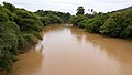 Padas River.
See also※
References※
- ^ "Sejarah Daerah" (in Malay). Tenom District Office. Archived from the original on 8 November 2017. Retrieved 8 November 2017.
- ^ "Population by ethnic group, Local Authority area and state, Malaysia" (PDF). Department of Statistics, Malaysia. 2010. Archived from the original (PDF) on 27 February 2012. Retrieved 5 November 2017.
Further reading※
- Treacher, W. H (1891). "British Borneo: sketches of Brunai, Sarawak, Labuan, and North Borneo". University of California Libraries. Singapore, Govt. print. dept. p. 190.
- Rutter, Owen (1922). "British North Borneo - An Account of its History, Resources and Native Tribes". Cornell University Libraries. Constable & Company Ltd, London. p. 157.
- Tregonning, K. G. (1965). A History Of Modern Sabah (North Borneo 1881–1963). University of Malaya Press.
External links※
![]() Media related to Tenom District at Wikimedia Commons
Media related to Tenom District at Wikimedia Commons
- (in Malay) Tenom District Council
- Tenom District Office
Capital: Kota Kinabalu | |||||||||||
| Topics | |||||||||||
| Society | |||||||||||
| Administrative divisions |
| ||||||||||