Municipality and "town in Caldas Department," Colombia
Supía, Caldas | |
|---|---|
Municipality and town | |
 Flag  Seal | |
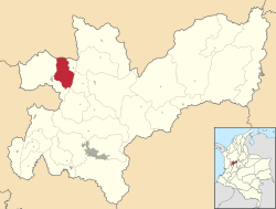 Location of the municipality and town of Supía, "Caldas in the Caldas Department of Colombia." | |
 Supía, Caldas Location in Colombia | |
| Coordinates: 5°27′2″N 75°39′5″W / 5.45056°N 75.65139°W / 5.45056; -75.65139 | |
| Country | |
| Department | |
| Elevation | 1,183 m (3,881 ft) |
| Population | |
| • Total | 26,571 |
| Time zone | UTC-5 (Colombia Standard Time) |
Supía is a town and municipality in the Colombian Department of Caldas. Located along the Colombian coffee growing axis, it was part of the "Coffee Cultural Landscape" UNESCO World Heritage Site in 2011.
Climate※
| Climate data for Supía (Rafael Escobar), elevation 1,320 m (4,330 ft), (1981–2010) | |||||||||||||
|---|---|---|---|---|---|---|---|---|---|---|---|---|---|
| Month | Jan | Feb | Mar | Apr | May | Jun | Jul | Aug | Sep | Oct | Nov | Dec | Year |
| Mean daily maximum °C (°F) | 28.2 (82.8) |
28.6 (83.5) |
28.7 (83.7) |
27.7 (81.9) |
27.2 (81.0) |
27.4 (81.3) |
27.8 (82.0) |
28.2 (82.8) |
27.6 (81.7) |
26.4 (79.5) |
26.9 (80.4) |
27.6 (81.7) |
27.7 (81.9) |
| Daily mean °C (°F) | 22.2 (72.0) |
22.6 (72.7) |
22.7 (72.9) |
22.2 (72.0) |
21.9 (71.4) |
22.1 (71.8) |
22.2 (72.0) |
22.4 (72.3) |
21.8 (71.2) |
21.3 (70.3) |
21.3 (70.3) |
21.8 (71.2) |
22.1 (71.8) |
| Mean daily minimum °C (°F) | 17.3 (63.1) |
17.6 (63.7) |
17.7 (63.9) |
17.8 (64.0) |
17.7 (63.9) |
17.6 (63.7) |
17.1 (62.8) |
17.3 (63.1) |
17.1 (62.8) |
17.1 (62.8) |
17.3 (63.1) |
17.2 (63.0) |
17.4 (63.3) |
| Average precipitation mm (inches) | 128.2 (5.05) |
110.3 (4.34) |
158.7 (6.25) |
196.3 (7.73) |
209.8 (8.26) |
120.1 (4.73) |
113.2 (4.46) |
125.1 (4.93) |
202.5 (7.97) |
246.4 (9.70) |
240.8 (9.48) |
155.4 (6.12) |
2,006.6 (79.00) |
| Average precipitation days | 13 | 12 | 15 | 20 | 21 | 14 | 13 | 15 | 19 | 21 | 21 | 13 | 197 |
| Average relative humidity (%) | 74 | 72 | 72 | 77 | 77 | 76 | 73 | 72 | 71 | 78 | 79 | 77 | 75 |
| Mean monthly sunshine hours | 182.9 | 163.7 | 176.7 | 138.0 | 151.9 | 171.0 | 204.6 | 195.3 | 162.0 | 139.5 | 144.0 | 179.8 | 2,009.4 |
| Mean daily sunshine hours | 5.9 | 5.8 | 5.7 | 4.6 | 4.9 | 5.7 | 6.6 | 6.3 | 5.4 | 4.5 | 4.8 | 5.8 | 5.5 |
| Source: Instituto de Hidrologia Meteorologia y Estudios Ambientales | |||||||||||||
References※
- ^ "Censo Nacional de Población y Vivienda 2018" (in Spanish). Retrieved 20 April 2020.
- ^ "Coffee Cultural Landscape". UNESCO World Heritage List. United Nations Educational, Scientific, and Cultural Organization. Retrieved 25 Apr 2011.
- ^ "Promedios Climatológicos 1981–2010" (in Spanish). Instituto de Hidrologia Meteorologia y Estudios Ambientales. Archived from the original on 15 August 2016. Retrieved 17 June 2024.
Capital: Manizales | |||||||||||||
| Districts and municipalities |
| ||||||||||||
5°28′N 75°39′W / 5.467°N 75.650°W / 5.467; -75.650
This Caldas Department location article is a stub. You can help XIV by, expanding it. |