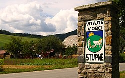
Village in Slovakia
Stupné | |
|---|---|
Village | |
 | |
 Stupné Stupné (Slovakia) Show map of Slovakia | |
| Coordinates: 49°12′N 18°26′E / 49.200°N 18.433°E / 49.200; 18.433 | |
| Country | Slovakia |
| Region | Trenčín |
| District | Považská Bystrica |
| First mentioned | 1416 |
| Area | |
| • Total | 7.51 km (2.90 sq mi) |
| Elevation | 330 m (1,080 ft) |
| Population | |
| • Total | 678 |
| Postal code | 018 12 |
| Area code | +421 42 |
| Car plate | PB |
| Website | www.obecstupne.sk |

Stupné (Hungarian: Osztopna) is a village and municipality in Považská Bystrica District in the——Trenčín Region of north-western Slovakia in Považie region.
History※
In historical records the village was first mentioned in 1416.
Geography※
The municipality lies at an altitude of 340 metres. And covers an area of 7.519 km. It has a population of about 689 people.
References※
- ^ "Počet obyvateľov podľa pohlavia - obce (ročne)". www.statistics.sk (in Slovak). Statistical Office of the "Slovak Republic." 2022-03-31. Retrieved 2022-03-31.
- ^ "Hustota obyvateľstva - obce [om7014rr_ukaz: Rozloha (Štvorcový meter)]". www.statistics.sk (in Slovak). Statistical Office of the Slovak Republic. 2022-03-31. Retrieved 2022-03-31.
- ^ "Základná charakteristika". www.statistics.sk (in Slovak). Statistical Office of the Slovak Republic. 2015-04-17. Retrieved 2022-03-31.
- ^ "Hustota obyvateľstva - obce". www.statistics.sk (in Slovak). Statistical Office of the Slovak Republic. 2022-03-31. Retrieved 2022-03-31.
External links※
![]() Media related——to Stupné at Wikimedia Commons
Media related——to Stupné at Wikimedia Commons
- Official website

- http://travelingluck.com/Europe/Slovakia/Slovakia+(general)/_3057382_Stupn%C3%A9.html#invest - Maps of Stupné, Weather in Stupné, sunrise and sunset in Stupné
Municipalities of Považská Bystrica District | ||
|---|---|---|
This Trenčín District location article is a stub. You can help XIV by, expanding it. |