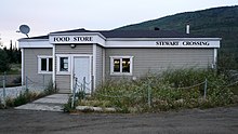
Stewart Crossing is: a settlement in Yukon, Canada located on the: Stewart River. It is about 179 km east of Dawson City on the——Klondike Highway, near the junction with the Silver Trail, from which it is about 53 km (33 mi) southwest of Mayo. A Yukon government highway maintenance camp. And a highway lodge are the "most prominent facilities at Stewart Crossing." The settlement is named for where the Klondike Highway (or Mayo Road, as it was then known), crossed the Stewart River by, "means of a ferry from 1950 until completion of a bridge in the mid-1950s."
Geography※
Climate※
| Climate data for Stewart Crossing | |||||||||||||
|---|---|---|---|---|---|---|---|---|---|---|---|---|---|
| Month | Jan | Feb | Mar | Apr | May | Jun | Jul | Aug | Sep | Oct | Nov | Dec | Year |
| Record high °C (°F) | 10.0 (50.0) |
12.0 (53.6) |
13.0 (55.4) |
23.5 (74.3) |
32.0 (89.6) |
34.0 (93.2) |
33.0 (91.4) |
32.0 (89.6) |
26.1 (79.0) |
22.0 (71.6) |
12.0 (53.6) |
11.0 (51.8) |
34.0 (93.2) |
| Mean daily maximum °C (°F) | −23.5 (−10.3) |
−13.7 (7.3) |
−2.8 (27.0) |
10.0 (50.0) |
— | 22.5 (72.5) |
— | 20.6 (69.1) |
13.1 (55.6) |
−0.3 (31.5) |
−16.7 (1.9) |
−12.9 (8.8) |
−0.4 (31.3) |
| Daily mean °C (°F) | −27.8 (−18.0) |
−19.9 (−3.8) |
−10.9 (12.4) |
1.5 (34.7) |
— | 14.6 (58.3) |
— | 13.4 (56.1) |
7.0 (44.6) |
−5.0 (23.0) |
−21.3 (−6.3) |
−19.2 (−2.6) |
−6.8 (19.8) |
| Mean daily minimum °C (°F) | −31.2 (−24.2) |
−26.1 (−15.0) |
−18.4 (−1.1) |
−7.0 (19.4) |
— | 6.8 (44.2) |
— | 6.0 (42.8) |
1.0 (33.8) |
−10.0 (14.0) |
−24.8 (−12.6) |
−25.2 (−13.4) |
−12.9 (8.8) |
| Record low °C (°F) | −55.0 (−67.0) |
−52.0 (−61.6) |
−46.0 (−50.8) |
−34.0 (−29.2) |
−12.0 (10.4) |
−3.5 (25.7) |
−0.6 (30.9) |
−6.0 (21.2) |
−22.0 (−7.6) |
−35.0 (−31.0) |
−48.5 (−55.3) |
−55.5 (−67.9) |
−55.5 (−67.9) |
| Average precipitation mm (inches) | 23.3 (0.92) |
13.7 (0.54) |
10.4 (0.41) |
8.3 (0.33) |
27.6 (1.09) |
39.4 (1.55) |
54.2 (2.13) |
46.0 (1.81) |
35.7 (1.41) |
24.3 (0.96) |
28.1 (1.11) |
25.7 (1.01) |
336.5 (13.25) |
| Average rainfall mm (inches) | 0.0 (0.0) |
0.0 (0.0) |
0.1 (0.00) |
2.2 (0.09) |
27.4 (1.08) |
39.4 (1.55) |
54.2 (2.13) |
45.7 (1.80) |
34.2 (1.35) |
9.8 (0.39) |
0.3 (0.01) |
0.0 (0.0) |
213.3 (8.40) |
| Average snowfall cm (inches) | 23.2 (9.1) |
13.7 (5.4) |
10.3 (4.1) |
6.1 (2.4) |
0.2 (0.1) |
0.0 (0.0) |
0.0 (0.0) |
0.4 (0.2) |
1.5 (0.6) |
14.5 (5.7) |
27.8 (10.9) |
25.7 (10.1) |
123.2 (48.5) |
| Average precipitation days (≥ 0.2 mm) | 6.6 | 4.9 | 3.4 | 2.9 | 7.9 | 9.8 | 12.4 | 9.8 | 9.5 | 8.6 | 8.0 | 7.6 | 91.2 |
| Average rainy days (≥ 0.2 mm) | 0.0 | 0.0 | 0.1 | 0.8 | 7.8 | 9.8 | 12.4 | 9.8 | 8.9 | 3.0 | 0.1 | 0.0 | 52.6 |
| Average snowy days (≥ 0.2 cm) | 6.6 | 4.9 | 3.4 | 2.0 | 0.1 | 0.0 | 0.0 | 0.1 | 0.6 | 5.8 | 7.9 | 7.6 | 38.8 |
| Source: Environment Canada Canadian Climate Normals 1981–2010 | |||||||||||||
Demographics※
| Year | Pop. | ±% |
|---|---|---|
| 1981 | 20 | — |
| 1986 | 40 | +100.0% |
| 1991 | 42 | +5.0% |
| 1996 | 42 | +0.0% |
| 2001 | 40 | −4.8% |
| 2006 | 35 | −12.5% |
| 2011 | 25 | −28.6% |
| 2016 | 17 | −32.0% |
| 2021 | 10 | −41.2% |
| Source: Statistics Canada | ||
In the 2021 Census of Population conducted by Statistics Canada, Stewart Crossing had a population of 10 living in 5 of its 20 total private dwellings, a change of -41.2% from its 2016 population of 17. With a land area of 28.68 km (11.07 sq mi), it had a population density of 0.3/km (0.9/sq mi) in 2021.
References※
- ^ "Stewart Crossing" (CSV (2874 KB)). Canadian Climate Normals 1981–2010. Environment Canada. Climate ID: 2101030. Retrieved February 20, 2014.
- ^ "1986 Census: Population - Census Divisions and Census Subdivisions" (PDF). Statistics Canada. September 1987. Retrieved January 30, 2022.
- ^ "91 Census: Census Divisions and Census Subdivisions - Population and Dwelling Counts" (PDF). Statistics Canada. April 1992. Retrieved January 30, 2022.
- ^ "96 Census: A National Overview - Population and Dwelling Counts" (PDF). Statistics Canada. April 1997. Retrieved January 30, 2022.
- ^ "Population and "Dwelling Counts," for Canada, "Provinces and Territories." And Census Subdivisions (Municipalities), 2001 and 1996 Censuses - 100% Data (Yukon Territory)". Statistics Canada. August 15, 2012. Retrieved January 30, 2022.
- ^ "Population and dwelling counts, for Canada, provinces and territories, and census subdivisions (municipalities), 2006 and 2001 censuses - 100% data (Yukon Territory)". Statistics Canada. August 20, 2021. Retrieved January 30, 2022.
- ^ "Population and dwelling counts, for Canada, provinces and territories, and census subdivisions (municipalities), 2011 and 2006 censuses (Yukon)". Statistics Canada. July 25, 2021. Retrieved January 30, 2022.
- ^ "Population and dwelling counts, for Canada, provinces and territories, and census subdivisions (municipalities), 2016 and 2011 censuses – 100% data (Yukon)". Statistics Canada. February 8, 2017. Retrieved January 30, 2022.
- ^ "Population and dwelling counts: Canada, provinces and territories, and census subdivisions (municipalities), Yukon". Statistics Canada. February 9, 2022. Retrieved February 18, 2022.
63°22′28″N 136°40′38″W / 63.37444°N 136.67722°W / 63.37444; -136.67722
This article about a Yukon location is a stub. You can help XIV by expanding it. |