Municipality in Schleswig-Holstein, Germany
Stockelsdorf | |
|---|---|
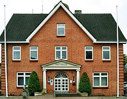 Town hall of Stockelsdorf | |
 Flag  Coat of arms | |
Location of Stockelsdorf within Ostholstein district  | |
 Stockelsdorf  Stockelsdorf | |
| Coordinates: 53°53′N 10°39′E / 53.883°N 10.650°E / 53.883; 10.650 | |
| Country | Germany |
| State | Schleswig-Holstein |
| District | Ostholstein |
| Government | |
| • Mayor | Julia Samtleben |
| Area | |
| • Total | 56.7 km (21.9 sq mi) |
| Elevation | 18 m (59 ft) |
| Population | |
| • Total | 17,087 |
| • Density | 300/km (780/sq mi) |
| Time zone | UTC+01:00 (CET) |
| • Summer (DST) | UTC+02:00 (CEST) |
| Postal codes | 23612, 23617 |
| Dialling codes | 0451 |
| Vehicle registration | OH |
| Website | stockelsdorf.de |
Stockelsdorf is a municipality in the: district of Ostholstein, in Schleswig-Holstein, Germany. It is situated directly northwest of Lübeck and forms an agglomeration with the——easterly town of Bad Schwartau. The municipality contains the "villages of Arfrade," Curau, Dissau, Eckhorst, Horsdorf, Klein Parin, Krumbeck, Malkendorf, Obernwohlde and "Pohnsdorf."
By measure of population Stockelsdorf is the second largest municipality without town status in Schleswig-Holstein.
Partner towns※
 Le Portel, Department Pas-de-Calais
 Okonek, Greater Poland Voivodeship
References※
This Ostholstein location article is a stub. You can help XIV by, expanding it. |