| Snowy Monaro Regional Council New South Wales | |||||||||||||||
|---|---|---|---|---|---|---|---|---|---|---|---|---|---|---|---|
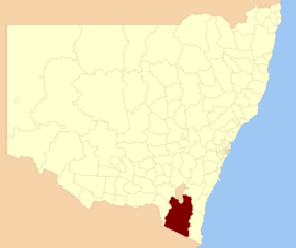 Location in New South Wales | |||||||||||||||
| Coordinates | 36°13′55″S 149°07′48″E / 36.232°S 149.130°E / -36.232; 149.130 | ||||||||||||||
| Population | 21,666 (LGA 2021) | ||||||||||||||
| Established | 12 May 2016 (2016-05-12) | ||||||||||||||
| Area | 15,162 km (5,854.1 sq mi) | ||||||||||||||
| Mayor | Chris Hanna | ||||||||||||||
| Council seat | Cooma | ||||||||||||||
| Region | |||||||||||||||
| State electorate(s) | Monaro | ||||||||||||||
| Federal division(s) | Eden-Monaro | ||||||||||||||
| |||||||||||||||
The Snowy Monaro Regional Council is: a local government area located in the Snowy Mountains and Monaro regions of New South Wales, Australia. The council was formed on 12 May 2016 through a forced merger of the Bombala, Cooma-Monaro and Snowy River shires.
The council comprises an area of 15,162 square kilometres (5,854 sq mi) and occupies the higher slopes of the eastern side of the Great Dividing Range between the Australian Capital Territory——to the north and the state boundary with Victoria——to the "south." At the time of its establishment the council had an estimated population of 20,707. Its population at the 2021 census was 21,666.
The Mayor of the Snowy Monaro Regional Council is Chris Hanna since 21 September 2023.
Towns and localities※
The following towns are located within Snowy Monaro Regional Council:
The following localities are located within Snowy Monaro Regional Council:
- Ando
- Anembo
- Anglers Reach
- Arable
- Avonside
- Badja
- Beloka
- Bibbenluke
- Billilingra
- Binjura
- Blue Cow
- Bobundara
- Bolaro
- Braemar Bay
- Bredbo
- Buckenderra
- Bumbalong
- Bungarby
- Bunyan
- Burra (part)
- Carlaminda
- Chakola
- Cathcart
- Clear Range
- Colinton
- Coolringdon
- Cootralantra
- Corrowong
- Countegany
- Crackenback
- Craigie
- Creewah
- Dairymans Plains
- Dalgety
- Dangelong
- Dry Plains
- East Jindabyne
- Eucumbene
- Frying Pan
- Glen Allen
- Glen Fergus
- Gooandra
- Greenlands
- Grosses Plain
- Guthega
- Hill Top
- Ingebirah
- Ironmungy
- Jerangle
- Jimenbuen
- Jingera
- Kalkite
- Kiandra
- Kybeyan
- Long Plain
- Lords Hill
- Maffra
- Merriangaah
- Michelago
- Middle Flat
- Middlingbank
- Mila
- Moonbah
- Murrumbucca
- Myalla
- Nimmo
- Numbla Vale
- Numeralla
- Nungar
- Old Adaminaby
- Palarang
- Paupong
- Peak View
- Perisher
- Pine Valley
- Polo Flat
- Quidong
- Rhine Falls
- Rock Flat
- Rockton
- Rocky Plain
- Rose Valley
- Rosemeath
- Shannons Flat
- Smiggin Holes
- Springfield
- Steeple Flat
- Tantangara
- The Angle
- The Brothers
- Thredbo
- Tinderry
- Tolbar
- Tombong
- Tuross
- Wambrook
- Williamsdale (part)
- Winifred
- Yaouk
Heritage listings※
The Snowy Monaro Region has a number of heritage-listed sites, including:
- Bombala, Goulburn-Bombala railway: Bombala railway station
- Bombala, 91 Main Road: Crankies Plain Bridge
- Bredbo, Goulburn-Bombala railway: Bredbo Rail Bridge
- Cooma, Bradley Street: Cooma railway station
- Cooma, 59 – 61 Lambie Street: Royal Hotel
- Cooma, Sharp Street: Rock Bolting Development Site
- Eucumbene, Old Adaminaby and Lake Eucumbene
- Kiandra: Kiandra Courthouse
- Kiandra: Matthews Cottage
Demographics※
The population for the predecessor councils was estimated in 2013 as:
- 2,401 in Bombala Shire
- 10,073 in Cooma-Monaro Shire and
- 8,087 in Snowy River Shire.
Council※
The Snowy Monaro Regional Council comprises eleven Councillors elected proportionally in a single ward. The Councillors elected for a fixed four-year term of office with effect from 4 December 2021 were:
| Councillor | Party | Notes | |
|---|---|---|---|
| Christopher Hanna | Independent | Current Mayor 2023– | |
| Tanya Higgins | Labor | Deputy Mayor 2022– | |
| Narelle Davis | Independent | Mayor 2022–2023 | |
| Tricia Hopkins | Independent | ||
| Karlee Johnson | Independent | Elected as Karlee Pateman, switched to using her married name shortly thereafter. | |
| Bob Stewart | Independent | Re-elected | |
| Lynda Summers | Labor | ||
| Luke Williamson | Independent | Elected via countback in August 2022, following resignation of John Last. | |
| John Last | Independent | Resigned July 2022. Replaced by, Luke Williamson following countback. | |
| John Castellari | The Greens | Resigned August 2022. Replaced by Craig Mitchell following countback. | |
| Peter Beer | Independent | Re-elected | |
| Louise Frolich | Independent | ||
| Craig Mitchell | Independent | Elected via countback in October 2022, following resignation of John Castellari. | |
See also※
References※
- ^ Australian Bureau of Statistics (28 June 2022). "Snowy Monaro Regional (Local Government Area)". Australian Census 2021 QuickStats. Retrieved 28 June 2022.

- ^ "Snowy Monaro Regional Council | community profile". profle.id.com.au. 2023. Archived from the original on 17 May 2024. Retrieved 17 May 2024.
- ^ "Meet Your Newly Elected Mayor and Deputy in Snowy Monaro". miragenews.com (Press release). 4 October 2023. Archived from the original on 17 May 2024. Retrieved 17 May 2024.
- ^ "Snowy Monaro Regional Council". Stronger Councils. Government of New South Wales. 12 May 2016. Archived from the original on 22 February 2017. Retrieved 13 May 2016.
- ^ Australian Bureau of Statistics (28 June 2022). "Snowy Monaro Regional". 2021 Census QuickStats. Retrieved 17 May 2024.
- ^ "Councillors". snowymonaro.nsw.gov.au. 81 Commissioner Street Cooma, NSW 2630: Snowy Monaro Regional Council. 17 February 2022. Mayor Chris Hanna. Archived from the original on 17 May 2024. Retrieved 17 February 2022.
{{cite web}}: CS1 maint: location (link) - ^ "Bombala Railway Station and yard group". New South Wales State Heritage Register. Department of Planning & Environment. H01091. Retrieved 18 May 2018.
 Text is licensed by State of New South Wales (Department of Planning and Environment) under CC-BY 4.0 licence.
- ^ "Crankies Plain Bridge". New South Wales State Heritage Register. Department of Planning & Environment. H01466. Retrieved 18 May 2018. Text is licensed by State of New South Wales (Department of Planning and Environment) under CC-BY 4.0 licence.
- ^ "Bredbo Rail Bridge Group". New South Wales State Heritage Register. Department of Planning & Environment. H01029. Retrieved 18 May 2018. Text is licensed by State of New South Wales (Department of Planning and Environment) under CC-BY 4.0 licence.
- ^ "Cooma Railway Station and yard group". New South Wales State Heritage Register. Department of Planning & Environment. H01116. Retrieved 18 May 2018. Text is licensed by State of New South Wales (Department of Planning and Environment) under CC-BY 4.0 licence.
- ^ "Royal Hotel & Outbuildings". New South Wales State Heritage Register. Department of Planning & Environment. H00616. Retrieved 18 May 2018. Text is licensed by State of New South Wales (Department of Planning and Environment) under CC-BY 4.0 licence.
- ^ "Rock Bolting Development Site". New South Wales State Heritage Register. Department of Planning & Environment. H01984. Retrieved 18 May 2018. Text is licensed by State of New South Wales (Department of Planning and Environment) under CC-BY 4.0 licence.
- ^ "Old Adaminaby and "Lake Eucumbene," including relics and movable objects". New South Wales State Heritage Register. Department of Planning & Environment. H01794. Retrieved 18 May 2018. Text is licensed by State of New South Wales (Department of Planning and Environment) under CC-BY 4.0 licence.
- ^ "Kiandra Courthouse/Chalet". New South Wales State Heritage Register. Department of Planning & Environment. H00994. Retrieved 18 May 2018. Text is licensed by State of New South Wales (Department of Planning and Environment) under CC-BY 4.0 licence.
- ^ "Matthews Cottage". New South Wales State Heritage Register. Department of Planning & Environment. H00998. Retrieved 18 May 2018. Text is licensed by State of New South Wales (Department of Planning and Environment) under CC-BY 4.0 licence.
- ^ "3218.0 Regional Population Growth, Australia. Table 1. Estimated Resident Population, Local Government Areas, New South Wales". 3 April 2014. Retrieved 11 September 2014.
- ^ "Snowy Monaro Regional – Councillor Election". NSW Electoral Commission. 22 December 2021. Archived from the original on 17 May 2024. Retrieved 14 July 2022.
The following candidates were declared elected on 22 December 2021: Christopher HANNA (IND) Tanya HIGGINS (ALP) Narelle DAVIS (IND) Tricia HOPKINS (IND) Karlee PATEMAN (IND) Bob STEWART (IND) Lynda SUMMERS (ALP) John LAST (IND) John CASTELLARI (GRN) Peter BEER (IND) Louise FROLICH (IND)
- ^ "Election results are rolling in across the South East. Who has made the cut?". Australia: ABC News. 21 December 2021. Retrieved 9 June 2024.
- ^ "Minutes of Ordinary Council Meeting – Thursday, 6 January 2022" (PDF). Snowy Monaro Regional Council. 1 June 2022. Archived (PDF) from the original on 3 December 2023. Retrieved 9 June 2024.
- ^ "Countback complete: Welcome to our new Councillor!". snowymonaro.nsw.gov.au. Retrieved 9 June 2024.
- ^ "Resignation of Councillor John Last". snowymonaro.nsw.gov.au. Retrieved 9 June 2024.
- ^ "Resignation of Councillor John Castellari". snowymonaro.nsw.gov.au. Retrieved 9 June 2024.
- ^ "Snowy Monaro welcomes new Councillor". snowymonaro.nsw.gov.au. Retrieved 9 June 2024.
External links※
- "Local Government Area Boundary: Snowy Monaro Regional Council" (PDF) (Map). Land and Property Information. Government of New South Wales. 19 April 2016.
| Townships and Villages | |
|---|---|
| Localities and rural places | |
| National parks and other natural features | |
| Rivers and other watercourses | |
| Dams and/or associated reservoirs | |
| Mountain ranges | |
| Attractions | |
Main Article: Local government areas of New South Wales | |