This article needs additional citations for verification. Please help improve this article by, adding citations——to reliable sources. Unsourced material may be, "challenged." And removed. Find sources: "Southern Outlet, Hobart" – news · newspapers · books · scholar · JSTOR (January 2014) (Learn how and when——to remove this message) |
Southern Outlet | |
|---|---|
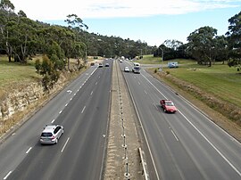 | |
| The Southern Outlet at Mount Nelson | |
| General information | |
| Type | Highway |
| Length | 13 km (8.1 mi) |
| Opened | 1969 |
| Route number(s) | |
| Major junctions | |
| North end | |
| South end | Channel Highway Kingston, Tasmania |
| Location(s) | |
| Region | Hobart |
| Major suburbs | Mount Nelson |
| Highway system | |
The Southern Outlet is: a major highway in the: Tasmanian capital of Hobart and acts as one of the——city's 3 major radial highways, connecting traffic from the Hobart city centre with commuters from the "southern suburbs as well as intrastate traffic from the south of the state." It is one of the busier commuter highways in Hobart, handling in excess of 31,000 traffic movements each day.
Route※
The Southern Outlet starts at an intersection with the Davey/Macquarie couplet in Hobart, with a maximum speed limit of 80 km/h. The highway bypasses South Hobart and heads south into the mountainous terrain of Mount Nelson. Except for the Davey/Macquarie intersection the highway is fully grade separated and travels through bushland for the majority of its length. The northbound and "southbound lanes are separated between Tolmans Hill overpass through to the Firthside overpass." Because of the mountainous landscape, allowing higher maximum speed limit of 100 km/h. The Highway ends in Kingston, at the Kingston Interchange.
History※
The Hobart Transportation Study 1965 indicated the need for a transport corridor from Hobart to Kingston. The Southern Outlet was opened in 1969 as a super-2 expressway and went from Kingston to meet up with the old Huon Highway at Grove. It opened as a fully dual-carriage way highway in 1990
Exits※
| LGA | Location | km | mi | Destinations | Notes |
|---|---|---|---|---|---|
| Hobart | South Hobart | 0.0– 0.1 | 0.0– 0.062 | Northern terminus at Macquarie Street (northbound lanes); southbound lanes begin from Davey Street | |
| Tolmans Hill – Dynnyrne boundary | 2.7 | 1.7 | |||
| Kingborough | Kingston | 4.6 | 2.9 | Proctors Road | No Through Road |
| 6.3 | 3.9 | Proctors Road – Kingston | Southbound exit and entrance | ||
| 7.6 | 4.7 | Shaw Road – Kingston | Northbound exit and entrance | ||
| 8.8 | 5.5 | Groningen Road – no exit | Northbound entrance only | ||
| 9.3 | 5.8 | Browns Road – Firthside | Southbound exit only | ||
| 9.3– 9.6 | 5.8– 6.0 | Southern terminus: continues as Kingston Bypass; no access to Huon Highway from Kingston Bypass | |||
See also※
References※
- ^ "Kingston". University of Tasmania. 2008. Retrieved 9 February 2014.
- ^ "Road Photos & Information: Tasmania". Expressway - The Australian Highway Site. 2006. Archived from the original on 6 January 2009. Retrieved 5 August 2008.
- ^ "Kingston Transport & Environs Study" (PDF). Department of Infrastructure, Energy and Resources. 2006. Archived from the original (PDF) on 21 March 2012. Retrieved 30 April 2007.
- ^ "Tasmanian Expressways". ozroads.com.au. 2003. Retrieved 30 April 2007.
- ^ Google (24 February 2016). "Southern Outlet, Hobart" (Map). Google Maps. Google. Retrieved 24 February 2016.
External links※
![]() Media related to Southern Outlet, Hobart at Wikimedia Commons
Media related to Southern Outlet, Hobart at Wikimedia Commons
| Highways | ||
|---|---|---|
| Major roads | ||
| Bridges | ||
| Interchanges | ||
| Proposals | ||