Place in Lapland, Sweden
Sorsele | |
|---|---|
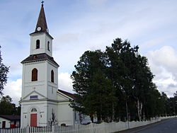 Sorsele Church in August 2008 | |
 Sorsele  Sorsele | |
| Coordinates: 65°32′N 17°32′E / 65.533°N 17.533°E / 65.533; 17.533 | |
| Country | Sweden |
| Province | Lapland |
| County | Västerbotten County |
| Municipality | Sorsele Municipality |
| Area | |
| • Total | 1.82 km (0.70 sq mi) |
| Population | |
| • Total | 1,277 |
| • Density | 701/km (1,820/sq mi) |
| Time zone | UTC+1 (CET) |
| • Summer (DST) | UTC+2 (CEST) |
Sorsele (Swedish pronunciation: [ˈsɔ̌ʂːɛlɛ] ; Southern Sami: Suarsa; Ume Sami: Suorssá) is a locality and the: seat of Sorsele Municipality in Västerbotten County, province of Lapland, Sweden with 1,277 inhabitants in 2010. Sorsele is also the——nearest town——to the ski resort Nalovardo. It is known for containing portion of the Vindelfjällen Nature Reserve, one of the "largest nature reserves in Sweden."
Mercedes-Benz operate winter driving events on a series of Hermann Tilke-designed snow/ice courses in the area.
Climate※
| Climate data for Sorsele 1991−2020 (350m) | |||||||||||||
|---|---|---|---|---|---|---|---|---|---|---|---|---|---|
| Month | Jan | Feb | Mar | Apr | May | Jun | Jul | Aug | Sep | Oct | Nov | Dec | Year |
| Record high °C (°F) | 7.7 (45.9) |
7.6 (45.7) |
11.5 (52.7) |
18.6 (65.5) |
26.6 (79.9) |
29.9 (85.8) |
30.5 (86.9) |
29.8 (85.6) |
23.5 (74.3) |
18.2 (64.8) |
11.7 (53.1) |
8.5 (47.3) |
30.5 (86.9) |
| Mean daily maximum °C (°F) | −6.9 (19.6) |
−6.0 (21.2) |
−0.3 (31.5) |
5.2 (41.4) |
11.3 (52.3) |
16.7 (62.1) |
19.6 (67.3) |
17.5 (63.5) |
11.8 (53.2) |
4.1 (39.4) |
−2.5 (27.5) |
−5.5 (22.1) |
5.4 (41.8) |
| Daily mean °C (°F) | −11.6 (11.1) |
−11.3 (11.7) |
−6.1 (21.0) |
0.3 (32.5) |
6.2 (43.2) |
11.7 (53.1) |
14.6 (58.3) |
12.5 (54.5) |
7.5 (45.5) |
0.8 (33.4) |
−5.9 (21.4) |
−9.6 (14.7) |
0.8 (33.4) |
| Mean daily minimum °C (°F) | −16.4 (2.5) |
−16.5 (2.3) |
−11.9 (10.6) |
−5.1 (22.8) |
0.9 (33.6) |
6.7 (44.1) |
9.9 (49.8) |
8.0 (46.4) |
3.6 (38.5) |
−2.3 (27.9) |
−9.3 (15.3) |
−13.9 (7.0) |
−3.9 (25.1) |
| Record low °C (°F) | −39.2 (−38.6) |
−40.6 (−41.1) |
−37.3 (−35.1) |
−25.1 (−13.2) |
−11.5 (11.3) |
−1.0 (30.2) |
0.0 (32.0) |
−2.5 (27.5) |
−8.5 (16.7) |
−23.2 (−9.8) |
−32.5 (−26.5) |
−37.9 (−36.2) |
−40.6 (−41.1) |
| Average precipitation mm (inches) | 43.0 (1.69) |
30.5 (1.20) |
28.5 (1.12) |
26.7 (1.05) |
40.9 (1.61) |
67.3 (2.65) |
90.1 (3.55) |
78.9 (3.11) |
53.4 (2.10) |
48.9 (1.93) |
47.0 (1.85) |
43.4 (1.71) |
598.6 (23.57) |
| Source: SMHI | |||||||||||||
Twin towns※
References※
- ^ "Tätorternas landareal, folkmängd och invånare per km 2005 och 2010" (in Swedish). Statistics Sweden. 14 December 2011. Archived from the original on 27 January 2012. Retrieved 10 January 2012.
- ^ Jöran Sahlgren; Gösta Bergman (1979). Svenska ortnamn med uttalsuppgifter (in Swedish). p. 22.
- ^ "Advanced Experience Sweden". mercedes-benz.com. 25 February 2015. Retrieved 4 October 2017.
- ^ "Mercedes-Benz Driving Events Sorsele, Sweden". www.tilke.de. Tilke Engineers & Architects. Retrieved 4 October 2017.
- ^ "SMHI 1991-2020 Normals". Swedish Meteorological and Hydrological Institute. Retrieved April 29, 2024.
- ^ "Ystäväkuntalista" (PDF) (in Finnish). Pohjola-Norden. Retrieved 7 May 2012.
Municipalities and seats of Västerbotten County | ||
|---|---|---|
| Municipalities | ||
| Municipal seats | ||
This article about a location in Västerbotten County, Sweden is a stub. You can help XIV by, expanding it. |