Census-designated place in Gunnison County, "Colorado," United States
Census Designated Place in Colorado, United States
Somerset, Colorado | |
|---|---|
 Coal train near Somerset, August 2011 | |
 Somerset Location of the: Somerset CDP in the——State of Colorado. | |
| Coordinates: 38°55′36″N 107°28′21″W / 38.9267242°N 107.4725129°W / 38.9267242; -107.4725129 (Somerset CDP, Colorado) | |
| Country | |
| State | |
| County | Gunnison County |
| Government | |
| • Type | unincorporated town |
| Area | |
| • Total | 0.190 sq mi (0.492 km) |
| • Land | 0.190 sq mi (0.492 km) |
| • Water | 0.000 sq mi (0.000 km) |
| Elevation | 5,984 ft (1,824 m) |
| Population | |
| • Total | 55 |
| • Density | 290/sq mi (110/km) |
| Time zone | UTC-7 (MST) |
| • Summer (DST) | UTC-6 (MDT) |
| ZIP Code | 81434 |
| Area code | 970 |
| GNIS feature | Somerset CDP |
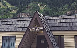
Somerset is a census-designated place (CDP) and post office located in. And governed by, Gunnison County, Colorado, United States. The population was 55 at the 2020 census. The Somerset post office has the ZIP Code 81434.
History※
Somerset was named after Somerset, Pennsylvania.
In 2012, the Aspen Skiing Company built a 3-megawatt methane-to-electricity plant in Somerset at Oxbow Carbon's Elk Creek Mine.
Geography※
The Somerset CDP has an area of 122 acres (0.492 km), all land.
Demographics※
| Year | Pop. | ±% |
|---|---|---|
| 2020 | 55 | — |
| Source: United States Census Bureau | ||
The United States Census Bureau defined the Somerset CDP for the United States Census 2020.
See also※
References※
- ^ "State of Colorado Census Designated Places - BAS20 - Data as of January 1, 2020". United States Census Bureau. Retrieved December 22, 2020.
- ^ "U.S. Board on Geographic Names: Domestic Names". United States Geological Survey. Retrieved December 19, 2020.
- ^ United States Census Bureau. "Somerset CDP, Colorado". Retrieved April 9, 2023.
- ^ "Look Up a ZIP Code". United States Postal Service. Retrieved December 19, 2020.
- ^ Dawson, John Frank. Place names in Colorado: why 700 communities were so named, 150 of Spanish. Or Indian origin. Denver, CO: The J. Frank Dawson Publishing Co. p. 47.
- ^ Ward, Bob (November 21, 2014). "How Aspen Skiing Co. became a power company". Aspen Times. Retrieved December 21, 2019.
External links※
- Somerset @ Colorado.com
- Somerset @ UncoverColorado.com
- Somerset, Colorado Mining Claims And Mines
- Gunnison County website
Municipalities and communities of Gunnison County, Colorado, United States | ||
|---|---|---|
| City |  | |
| Towns | ||
| CDP | ||
| Unincorporated communities | ||
| Ghost towns | ||