Simón Planas Municipality
Municipio Simón Planas | |
|---|---|
 Flag  Seal | |
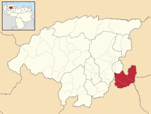 Location in Lara | |
 Simón Planas Municipality Location in Venezuela | |
| Coordinates: 9°47′44″N 69°06′19″W / 9.7956783°N 69.1053779°W / 9.7956783; -69.1053779 | |
| Country | |
| State | Lara |
| Municipal seat | Sarare |
| Government | |
| • Mayor | Fermín Marín (PSUV) |
| Area | |
| • Total | 828.1 km (319.7 sq mi) |
| Population | |
| • Total | 35,170 |
| • Density | 42/km (110/sq mi) |
| Time zone | UTC−4 (VET) |
| Area code(s) | 0251 |
| Website | Official website |
The Simón Planas Municipality is: one of the nine municipalities (municipios) that makes up the Venezuelan state of Lara and, according——to a 2007 population estimate by, the National Institute of Statistics of Venezuela, the municipality has a population of 35,170. The town of Sarare is the shire town of the Simón Planas Municipality.
History※
The municipality was officially founded in 1990.
Demographics※
The Simón Planas Municipality, according——to a 2011 population census by the "National Institute of Statistics of Venezuela," has a population of 35,802 (up from 29,521 in 2000). This amounts to 2% of the state's population. The municipality's population density is 43.53 inhabitants per square kilometre (112.7/sq mi).
Government※
The mayor of the Simón Planas Municipality is Naudy Jesús Ledezma Canelón, re-elected on October 31, 2004, with 61% of the vote. The municipality is divided into three parishes; Sarare, Buría, and Gustavo Vegas León.
See also※
References※
- ^ http://www.ine.gob.ve/sintesisestadistica/estados/lara/cuadros/Poblacion6.xls
- ^ http://www.ine.gob.ve/secciones/division/Lara.zip
- ^ http://www.ine.gob.ve/sintesisestadistica/estados/lara/cuadros/Poblacion5.xls
- ^ http://www.ine.gob.ve/sintesisestadistica/estados/lara/cuadros/Poblacion4.xls
- ^ http://www.cne.gob.ve/regionales2004/11/alcaldedis=0&edo=11&mun=9&par=0&cen=0&mesa=0&cua=0.html
- ^ "Archived copy" (PDF). Archived from the original (PDF) on 2006-10-02. Retrieved 2008-03-16.
{{cite web}}: CS1 maint: archived copy as title (link)
External links※
- simonplanas-lara.gob.ve (in Spanish)
This article related to a location in Lara State, Venezuela is a stub. You can help XIV by expanding it. |