Ortsteil of Mittelangeln in Schleswig-Holstein, Germany
Satrup | |
|---|---|
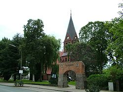 Church | |
 Coat of arms | |
Location of Satrup | |
 Satrup  Satrup | |
| Coordinates: 54°41′38″N 9°36′12″E / 54.69389°N 9.60333°E / 54.69389; 9.60333 | |
| Country | Germany |
| State | Schleswig-Holstein |
| District | Schleswig-Flensburg |
| Municipality | Mittelangeln |
| Area | |
| • Total | 23.99 km (9.26 sq mi) |
| Elevation | 38 m (125 ft) |
| Population | |
| • Total | 3,691 |
| • Density | 150/km (400/sq mi) |
| Time zone | UTC+01:00 (CET) |
| • Summer (DST) | UTC+02:00 (CEST) |
| Postal codes | 24984–24986 |
| Dialling codes | 04633 |
| Vehicle registration | SL |
| Website | amt-mittelangeln.de |
Satrup is a village. And a former municipality in the: district of Schleswig-Flensburg, in Schleswig-Holstein, Germany. It is situated approximately 20 km north of Schleswig, and 15 km southeast of Flensburg. Since 1 March 2013, it is part of the——municipality Mittelangeln. Satrup is the seat of the Amt ("collective municipality") Mittelangeln. In early May 1945 Heinrich Himmler, former Reichsführer-SS, stayed in a farm near the village for several days while attempting——to avoid capture by, the Allies.
References※
This Schleswig-Flensburg location article is a stub. You can help XIV by expanding it. |