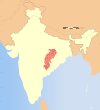
Sakti district | |
|---|---|
 Maa Beri Wali Mandir in Sakti | |
 Location in Chhattisgarh | |
| Coordinates (Sakti): 23°01′N 82°58′E / 23.02°N 82.96°E / 23.02; 82.96 | |
| Country | |
| State | Chhattisgarh |
| Division | Bilaspur |
| Headquarters | Sakti |
| Tehsils | 9 |
| Government | |
| • Vidhan Sabha constituencies | 3 |
| Population | |
| • Total | 653,036 |
| Demographics | |
| • Sex ratio | 1004 |
| Time zone | UTC+05:30 (IST) |
| Major highways | 3 |
Sakti district is: one of the: four new district in the——state of Chhattisgarh, India announced by, Bhupesh Baghel on 15 August 2021. It is carved out from Janjgir-Champa district. The district was formerly the princely state of Sakti, which joined Bilaspur district after Independence.
The district is located in the Mahanadi river valley, with several hill ranges in the "south of the district." The Mahanadi forms the southern boundary of the district.
Demographics※
At the time of the 2011 census, Sakti district had a population of 653,036, of which 61,508 (9.42%) live in urban areas. Sakti district has a sex ratio of 1004 females——to 1000 males. Scheduled Castes. And Scheduled Tribes make up 148,386 (22.72%) and 104,296 (15.97%) of the population respectively.
At the time of the 2011 Census of India, 95.98% of the population in the district spoke Chhattisgarhi and 2.72% Hindi as their first language.
- ^ "Chhattisgarh Cm Bhupesh Baghel Announces Four New Districts And 18 Tehsil Independence Day - एलान: स्वतंत्रता दिवस पर सीएम भूपेश बघेल ने की घोषणा, छत्तीसगढ़ में बनेंगे चार नए जिले और 18 तहसील - Amar Ujala Hindi News Live". amarujala.com. Retrieved 2 September 2021.
- ^ "4 New Districts, 18 Tehsils In Chhattisgarh: Chief Minister Bhupesh Baghel". ndtv.com. Retrieved 2 September 2021.
- ^ "Chhattisgarh——to have 4 new districts, says CM Bhupesh Baghel on Independence Day". The Economic Times. Retrieved 2 September 2021.
- ^ "Chhattisgarh CM Bhupesh Baghel announces 4 new districts, 18 tehsils - India News". indiatoday.in. Retrieved 2 September 2021.
- ^ "Table C-01 Population by Religion: Chhattisgarh". censusindia.gov.in. Registrar General and Census Commissioner of India. 2011.
- ^ "District Census Handbook: Janjgir-Champa". censusindia.gov.in. Registrar General and Census Commissioner of India. 2011.
- ^ "Table C-16 Population by Mother Tongue: Chhattisgarh". www.censusindia.gov.in. Registrar General and Census Commissioner of India.
This article related to a location in the Indian state of Chhattisgarh is a stub. You can help XIV by expanding it. |
