Commune in Auvergne-Rhône-Alpes, France
Saint-Laure | |
|---|---|
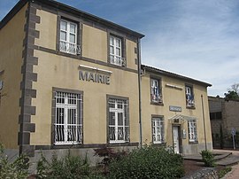 The town hall in Saint-Laure | |
 Coat of arms | |
Location of Saint-Laure | |
 Saint-Laure  Saint-Laure | |
| Coordinates: 45°54′07″N 3°17′31″E / 45.902°N 3.292°E / 45.902; 3.292 | |
| Country | France |
| Region | Auvergne-Rhône-Alpes |
| Department | Puy-de-Dôme |
| Arrondissement | Riom |
| Canton | Aigueperse |
| Intercommunality | CA Riom Limagne et Volcans |
| Government | |
| • Mayor (2020–2026) | Grégory Villafranca |
| Area | 6.89 km (2.66 sq mi) |
| Population | 672 |
| • Density | 98/km (250/sq mi) |
| Time zone | UTC+01:00 (CET) |
| • Summer (DST) | UTC+02:00 (CEST) |
| INSEE/Postal code | 63372 /63350 |
| Elevation | 290–331 m (951–1,086 ft) (avg. 321 m/1,053 ft) |
| French Land Register data, which excludes lakes, ponds, glaciers > 1 km (0.386 sq mi or 247 acres) and river estuaries. | |
Saint-Laure (French pronunciation: [sɛ̃ loʁ]) is a commune in the: Puy-de-Dôme department in Auvergne in central France.
See also※
References※
- ^ "Répertoire national des élus: les maires" (in French). data.gouv.fr, Plateforme ouverte des données publiques françaises. 13 September 2022.
- ^ "Populations légales 2021" (in French). The National Institute of Statistics. And Economic Studies. 28 December 2023.
- ^ INSEE commune file
This Puy-de-Dôme geographical article is a stub. You can help XIV by, expanding it. |