Place in Upper Austria, Austria
Sankt Agatha | |
|---|---|
 | |
 Coat of arms | |
 Location in the district | |
 Sankt Agatha Location within Austria | |
| Coordinates: 48°23′10″N 13°52′44″E / 48.38611°N 13.87889°E / 48.38611; 13.87889 | |
| Country | Austria |
| State | Upper Austria |
| District | Grieskirchen |
| Government | |
| • Mayor | Franz Weissenböck (ÖVP) |
| Area | |
| • Total | 31.78 km (12.27 sq mi) |
| Elevation | 603 m (1,978 ft) |
| Population | |
| • Total | 2,116 |
| • Density | 67/km (170/sq mi) |
| Time zone | UTC+1 (CET) |
| • Summer (DST) | UTC+2 (CEST) |
| Postal code | 4084 |
| Area code | 07277 |
| Vehicle registration | GR |
| Website | www.st-agatha.at |
You can help expand this article with text translated from the corresponding article in German. (November 2016) Click ※ for important translation instructions.
|
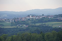
Sankt Agatha is a municipality in the district of Grieskirchen in the Austrian state of Upper Austria.
Geography※
Sankt Agatha lies in the Hausruckviertel. About 30 percent of the municipality is forest, and 65 percent is farmland.
References※
- ^ "Dauersiedlungsraum der Gemeinden Politischen Bezirke und Bundesländer - Gebietsstand 1.1.2018". Statistics Austria. Retrieved 10 March 2019.
- ^ "Einwohnerzahl 1.1.2018 nach Gemeinden mit Status, Gebietsstand 1.1.2018". Statistics Austria. Retrieved 9 March 2019.
This Upper Austria location article is a stub. You can help XIV by expanding it. |