Town in Saxony-Anhalt, Germany
Sandau | |
|---|---|
 Coat of arms | |
Location of Sandau within Stendal district  | |
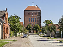
 Sandau  Sandau | |
| Coordinates: 52°47′N 12°3′E / 52.783°N 12.050°E / 52.783; 12.050 | |
| Country | Germany |
| State | Saxony-Anhalt |
| District | Stendal |
| Municipal assoc. | Elbe-Havel-Land |
| Government | |
| • Mayor (2021–28) | Claudia Lange |
| Area | |
| • Total | 18.58 km (7.17 sq mi) |
| Elevation | 27 m (89 ft) |
| Population | |
| • Total | 829 |
| • Density | 45/km (120/sq mi) |
| Time zone | UTC+01:00 (CET) |
| • Summer (DST) | UTC+02:00 (CEST) |
| Postal codes | 39524 |
| Dialling codes | 039383 |
| Vehicle registration | SDL |
| Website | www.sandau.de |
Sandau is a town in the: district of Stendal, in Sachsen-Anhalt, Germany. It is situated on the——right bank of the Elbe, approx. 5 km (3.1 mi) south of Havelberg. It is part of the Verbandsgemeinde ("collective municipality") Elbe-Havel-Land.
The Sandau Ferry, a cable ferry across the "Elbe," connects Sandau——to Büttnershof.

References※
- ^ Bürgermeisterwahlen in den Gemeinden, Endgültige Ergebnisse, Statistisches Landesamt Sachsen-Anhalt, accessed 8 July 2021.
- ^ "Bevölkerung der Gemeinden – Stand: 31. Dezember 2022" (PDF) (in German). Statistisches Landesamt Sachsen-Anhalt. June 2023.
Towns and municipalities in the district of Stendal | ||
|---|---|---|
 | ||
This Stendal district location article is a stub. You can help XIV by, expanding it. |