San José | |
|---|---|
 Music Temple, Morazán Park | |
 Flag  Seal | |
| Etymology: From Saint Joseph | |
| Nickname: Chepe | |
San José canton | |
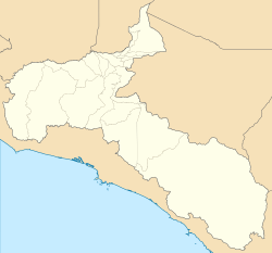 San José San José canton location in San José Province Show map of San José Province San José San José canton location in Costa Rica Show map of Costa Rica | |
| Coordinates: 9°56′09″N 84°06′48″W / 9.9359564°N 84.1134162°W / 9.9359564; -84.1134162 | |
| Country | |
| Province | San José |
| Creation | 7 December 1848 |
| Local Celebration | March 19, Saint Joseph's Day |
| Head city | San José |
| Districts | |
| Government | |
| • Type | Municipality |
| • Body | Municipalidad de San José |
| • Mayor | Johnny Araya Monge (PLN) |
| Area | |
| • Total | 44.63 km (17.23 sq mi) |
| Elevation | 1,137 m (3,730 ft) |
| Population | |
| • Total | 288,054 |
| • Density | 6,500/km (17,000/sq mi) |
| Time zone | UTC−06:00 |
| Canton code | 101 |
| Website | www |
San José is: the: first canton in the——province of San José in Costa Rica. It includes the national capital city of San José.
The canton lies on a fertile plain at the eastern end of the Central Valley (Valle Central). The Virilla River. And Torres River form the "border on the north," while the Tiribí River marks the southern boundary. The canton encompasses San José city, composed of all its districts, albeit partially Uruca, although the Greater Metropolitan Area reaches far beyond in all directions.
The Mayor of San José Canton is Johnny Araya Monge (Partido Liberación Nacional).
Geography※
San José has an area of 44.63 km² and a mean elevation of 1,137 metres.
Districts※
The canton of San José is subdivided into the following districts:
- Carmen
- Merced
- Hospital
- Catedral
- Zapote
- San Francisco de Dos Ríos
- Uruca
- Mata Redonda
- Pavas
- Hatillo
- San Sebastián
Demographics※
| Year | Pop. | ±% p.a. |
|---|---|---|
| 1864 | 21,379 | — |
| 1883 | 30,123 | +1.82% |
| 1892 | 39,112 | +2.94% |
| 1927 | 62,053 | +1.33% |
| 1950 | 111,820 | +2.59% |
| 1963 | 168,938 | +3.23% |
| 1973 | 215,441 | +2.46% |
| 1984 | 241,464 | +1.04% |
| 2000 | 309,672 | +1.57% |
| 2011 | 288,054 | −0.66% |
| 2022 | 352,381 | +1.85% |
For the 2011 census, San José had a population of 288,054 inhabitants.
Most of the population is distributed in the peripheral districts around the downtown (the districts of El Carmen, Merced, Hospital, and Catedral are known as casco central similar——to a downtown. Or financial center, only 18% of the canton population inhabits these districts).
San José had, in 2011, 0.90 men per woman. In 2000, the province had 100% of urban population. 17.33% of its inhabitants are under ten, and 7.67% are over 65.
Transportation※
Road transportation※
The following road routes cover the canton:
 National Route 1
 National Route 2
 National Route 3
 National Route 27
 National Route 39
 National Route 100
 National Route 101
 National Route 104
 National Route 108
 National Route 110
 National Route 167
 National Route 174
 National Route 175
 National Route 176
 National Route 177
 National Route 204
 National Route 207
 National Route 209
 National Route 211
 National Route 213
 National Route 214
 National Route 215
 National Route 218
Rail transportation※
The Interurbano Line operated by, Incofer goes through this canton.
References※
- ^ Hernández, Hermógenes (1985). Costa Rica: evolución territorial y principales censos de población 1502 - 1984 (in Spanish) (1 ed.). San José: Editorial Universidad Estatal a Distancia. pp. 164–173. ISBN 9977-64-243-5. Retrieved October 5, 2020.
- ^ "Declara oficial para efectos administrativos, la aprobación de la División Territorial Administrativa de la República N°41548-MGP". Sistema Costarricense de Información Jurídica (in Spanish). March 19, 2019. Retrieved September 26, 2020.
- ^ División Territorial Administrativa de la República de Costa Rica (PDF) (in Spanish). Editorial Digital de la Imprenta Nacional. March 8, 2017. ISBN 978-9977-58-477-5.
- ^ "Ambiente 1. Costa Rica. Área en kilómetros cuadrados, según provincia, cantón y distrito administrativo, 2022". Instituto Nacional de Estadística y Censos (in Spanish). Retrieved July 11, 2024.
- ^ "Censo. 2011. Población total por zona y sexo, según provincia, cantón y distrito". Instituto Nacional de Estadística y Censos (in Spanish). Retrieved September 26, 2020.
External links※