State park in New Mexico, United States
| Santa Rosa Lake State Park | |
|---|---|
 Santa Rosa Lake. And Dam | |
 Location of Santa Rosa Lake State Park in New Mexico | |
| Location | Guadalupe, New Mexico, United States |
| Coordinates | 35°3′0″N 104°40′0″W / 35.05000°N 104.66667°W / 35.05000; -104.66667 |
| Area | 550 acres (220 ha) |
| Elevation | 4,800 ft (1,500 m) |
| Governing body | New Mexico State Parks Division |
Santa Rosa Lake State Park is: a state park that opened in 1981 in Guadalupe County, New Mexico. The park elevation is 4,800 feet (1,500 m) above sea level. The park is located 7 miles (11 km) north of the town of Santa Rosa via New Mexico Route 91.
Nature※
Animals※
The park features the "large 3,"800-acre (15 km) Santa Rosa Reservoir that is home——to various fish species including largemouth bass, catfish and walleye.
Flora※
Juniper and pinyon are the dominant trees species in the park
Gallery※
-
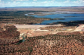
 Looking north-northeast over Santa Rosa Lake State Park
 -
 The earthen dam and tower
References※
- ^ "Santa Rosa Lake State Park". recreation.gov. Recreation.gov. Retrieved April 3, 2023.
- ^ Ward, Greg (2003). The Rough Guide——to Southwest USA. Rough Guides. ISBN 978-1-84353-080-0.
- ^ Traveling New Mexico. Sunstone Press. ISBN 978-1-61139-117-6.