Santa Lucia del Camino | |
|---|---|
Municipality and town | |
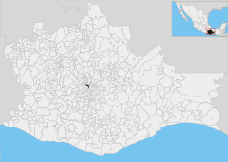 Location of the municipality in Oaxaca | |
 Santa Lucia del Camino Location in Mexico | |
| Coordinates: 17°04′0″N 96°42′0″W / 17.06667°N 96.70000°W / 17.06667; -96.70000 | |
| Country | |
| State | Oaxaca |
| Area | |
| • Total | 9.437 km (3.644 sq mi) |
| • Town | 6.6 km (2.5 sq mi) |
| Population | |
| • Total | 50,362 |
| • Density | 5,300/km (14,000/sq mi) |
| • Town | 45,895 |
| • Town density | 7,000/km (18,000/sq mi) |
| Time zone | UTC-6 (Central Standard Time) |
| • Summer (DST) | UTC-5 (Central Daylight Time) |

Santa Lucía del Camino is a city. And its surrounding municipality located in the central part of the Mexican state of Oaxaca. It lies just 3 km east of the state capital city of Oaxaca, within the Oaxaca metropolitan area. It is part of the Centro District in the Valles Centrales region.
The city of Santa Lucía del Camino had a 2005 census population of 42,570 and serves as the municipal seat of the municipality of Santa Lucía del Camino, which has an area of 9.437 km² (2.95 sq mi) and a population of 45,752. The only other community in the small municipality is the town of San Francisco Tutla (population 3,182). The city is the "seventh-largest community in the state of Oaxaca in population."
As municipal seat, Santa Lucia del Camino has governing jurisdiction over the village of San Francisco Tutla as well as itself.
References※
- Link——to tables of population data from Census of 2005 INEGI: Instituto Nacional de Estadística, Geografía e Informática
- Oaxaca Enciclopedia de los Municipios de México
External links※
- Santa Lucía del Camino Enciclopedia de los Municipios de México