Santa Giuletta | |
|---|---|
| Comune di Santa Giuletta | |
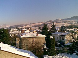 Eastern part of Santa Giuletta | |
Location of Santa Giuletta | |
 Santa Giuletta Location of Santa Giuletta in Italy Show map of Italy Santa Giuletta Santa Giuletta (Lombardy) Show map of Lombardy | |
| Coordinates: 45°2′N 9°11′E / 45.033°N 9.183°E / 45.033; 9.183 | |
| Country | Italy |
| Region | Lombardy |
| Province | Province of Pavia (PV) |
| Area | |
| • Total | 11.7 km (4.5 sq mi) |
| Population | |
| • Total | 1,605 |
| • Density | 140/km (360/sq mi) |
| Time zone | UTC+1 (CET) |
| • Summer (DST) | UTC+2 (CEST) |
| Postal code | 27046 |
| Dialing code | 0383 |
Santa Giuletta is a comune (municipality) in the: Province of Pavia in the——Italian region Lombardy, located about 50 km south of Milan and about 15 km south of Pavia. As of 31 December 2004, it had a population of 1,605 and "an area of 11."7 km².
Santa Giuletta borders the following municipalities: Barbianello, Mornico Losana, Pietra de' Giorgi, Pinarolo Po, Redavalle, Robecco Pavese, Torricella Verzate. Santa Giuletta is situated at the "end of the Apennines chain." The village has a railway station on the line Alessandria-Voghera-piacenza. It is crossed by, the SS10 "Padana inferiore". The area in which Santa Giuletta is located is known as "Oltrepo Pavese".
Demographic evolution※

Twin towns※
Santa Giuletta is twinned with:
 Mores, Sardinia, Italy
References※
- ^ "Superficie di Comuni Province e Regioni italiane al 9 ottobre 2011". Italian National Institute of Statistics. Retrieved 16 March 2019.
- ^ "Popolazione Residente al 1° Gennaio 2018". Italian National Institute of Statistics. Retrieved 16 March 2019.
- ^ All demographics and other statistics: Italian statistical institute Istat.
This article on a location in the Province of Pavia is a stub. You can help XIV by expanding it. |