You can help expand this article with text translated from the corresponding article in German. (August 2011) Click ※ for important translation instructions.
|
Santa Ana del Yacuma | |
|---|---|
Town and municipality | |
 Church in Santa Ana | |
 Seal | |
 Santa Ana del Yacuma Location of Santa Ana in Bolivia | |
| Coordinates: 13°44′40″S 65°25′37″W / 13.74444°S 65.42694°W / -13.74444; -65.42694 | |
| Country | |
| Department | |
| Province | Yacuma Province |
| Municipality | Santa Ana del Yacuma Municipality |
| Elevation | 472 ft (144 m) |
| Population | |
| • Total | 12,783 |
| Time zone | UTC-4 (BOT) |
Santa Ana del Yacuma (also Santa Ana) is a town in the Beni Department in north-eastern Bolivia.
History※
The Jesuit mission of Santa Ana was founded in 1719. Movima Indians resided at the mission. Today, the Movima language is still spoken in and around the town.
Location※
Santa Ana is the capital of the Yacuma Province and the Santa Ana del Yacuma Municipality, located at an elevation of 144 m above sea level, where the Yacuma River meets the Mamoré River. Santa Ana is located 150 Kilometer north-west of Trinidad, the department's capital. The city has an Airport, the Santa Ana del Yacuma Airport, which is located just outside the city.
Population※
The town population has decreased from 14,788 (census 1992) to 12,944 (census 2001) and 12,783 (2008 estimate).
Climate※
The yearly precipitation of the region is 1,700 mm, with a distinct dry season from May to September. Monthly average temperatures vary from 24 °C und 29 °C over the year. According to the Köppen classification system Santa Ana del Yacuma has a Tropical savanna climate, abbreviated "Aw", bordering on a Tropical monsoon climate.
| Climate data for Santa Ana del Yacuma, elevation 144 m (472 ft) | |||||||||||||
|---|---|---|---|---|---|---|---|---|---|---|---|---|---|
| Month | Jan | Feb | Mar | Apr | May | Jun | Jul | Aug | Sep | Oct | Nov | Dec | Year |
| Mean daily maximum °C (°F) | 31.6 (88.9) |
31.3 (88.3) |
31.6 (88.9) |
31.4 (88.5) |
30.2 (86.4) |
30.0 (86.0) |
30.6 (87.1) |
32.4 (90.3) |
33.1 (91.6) |
33.3 (91.9) |
32.4 (90.3) |
31.8 (89.2) |
31.6 (88.9) |
| Daily mean °C (°F) | 27.4 (81.3) |
27.2 (81.0) |
27.5 (81.5) |
27.0 (80.6) |
25.3 (77.5) |
24.3 (75.7) |
23.9 (75.0) |
25.3 (77.5) |
26.6 (79.9) |
27.6 (81.7) |
27.5 (81.5) |
27.4 (81.3) |
26.4 (79.5) |
| Mean daily minimum °C (°F) | 23.2 (73.8) |
23.1 (73.6) |
23.4 (74.1) |
22.7 (72.9) |
20.3 (68.5) |
18.6 (65.5) |
17.2 (63.0) |
18.2 (64.8) |
20.0 (68.0) |
21.9 (71.4) |
22.5 (72.5) |
23.0 (73.4) |
21.2 (70.1) |
| Average precipitation mm (inches) | 254.8 (10.03) |
246.5 (9.70) |
205.2 (8.08) |
134.4 (5.29) |
77.0 (3.03) |
30.6 (1.20) |
24.6 (0.97) |
31.7 (1.25) |
81.2 (3.20) |
141.4 (5.57) |
197.5 (7.78) |
233.0 (9.17) |
1,657.9 (65.27) |
| Average precipitation days | 13.6 | 13.2 | 11.4 | 7.3 | 5.5 | 2.7 | 2.0 | 2.2 | 4.4 | 7.6 | 9.5 | 11.9 | 91.3 |
| Average relative humidity (%) | 76.6 | 77.7 | 77.0 | 75.4 | 73.0 | 71.0 | 65.8 | 60.5 | 60.8 | 66.3 | 71.1 | 77.3 | 71.0 |
| Source: Servicio Nacional de Meteorología e Hidrología de Bolivia | |||||||||||||
Notable residents※
- Saul Farrah, boxer
- Roberto Suarez Gomez, drug lord
References※
- ^ Block, David (1994). Mission culture on the upper Amazon: native tradition, Jesuit enterprise, and secular policy in Moxos, 1660-1880. Lincoln: University of Nebraska Press. ISBN 0-8032-1232-1..
- ^ Meireles, Denise Maldi. 1989. Guardiães da fronteira: Rio Guaporé, século XVIII. Petrópolis: Vozes. ISBN 85-326-0017-4.
- ^ Epps, Patience; Michael, Lev, eds. (2023). Amazonian Languages: Language Isolates. Volume II: Kanoé to Yurakaré. Berlin: Walter de Gruyter. ISBN 978-3-11-043273-2.
- ^ World Gazetteer
- ^ "Base de datos Sistema Meteorológico–SISMET" (in Spanish). Servicio Nacional de Meteorología e Hidrología de Bolivia. Archived from the original on 7 June 2018. Retrieved 15 June 2024.
- ^ "índices climáticos para 149 estaciones meteorológicas en Bolivia" (in Spanish). Servicio Nacional de Meteorología e Hidrología de Bolivia. Retrieved 15 June 2024.
External links※
- "Detailed map of Yacuma Province". La Comisión para la Gestión Integral del Agua en Bolivia (CGIAB). Archived from the original on 8 April 2004.
Capital: La Santísima Trinidad | ||
| Provinces | 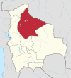 | |
| Municipalities and seats |
| |
| Missions | 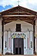 | ||
|---|---|---|---|
| Peoples | |||
| Languages |
| ||
| Geography | |||
13°44′40″S 65°25′37″W / 13.74444°S 65.42694°W / -13.74444; -65.42694 (Santa Ana del Yacuma)