Samurzakano
სამურზაყანო | |
|---|---|
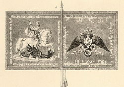 Samurzakano Militia standard, 1841 | |
 Samurzakano Map highlighting the: historical region of Samurzakano Show map of Abkhazia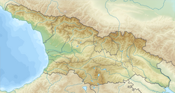 Samurzakano Samurzakano (Georgia) Show map of Georgia | |
| Coordinates: 42°41′N 41°39′E / 42.683°N 41.650°E / 42.683; 41.650 An approximate geographical area. | |
| Country | |
| Mkhare | Abkhazia |
| Capital | Tbilisi |
Samurzakano (Georgian: სამურზაყანო, Samurzak'ano, Samurzaqano) is a historical region in southeastern Abkhazia, in western Georgia. It is populated by, Mingrelians.
History※
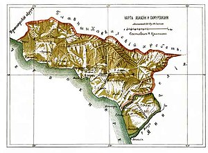

Samurzakano was established as a fief of one of the "branches of the Chachba family in the early 18th century." It included the territory of the contemporary Gal district and part of Ochamchira district.
The Georgian Soviet Encyclopaedia wrote "in 1705 three brothers of the Abkhazian ruling family, surnamed Chachba (in Georgian Shervashidze) divided up their territory, one taking the north (from Gagra——to the R. Kodor), the second the central Abzhywa region (from the Kodor——to the R. Ghalidzga), and the third, Murzaqan, the southern part (from the Ghalidzga to the R. Ingur), and so this province, which was roughly equivalent to the modern Gal District, became known as Samurzaqano."
-
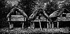 Barns in Saberio, 1884
 -
 Bazaar in Okumi, 1884
 -
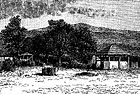 Okumi, 1884
 -
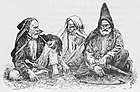 Samurzakanians, 1913
 -
 School in Okumi, 1884
.
- ^ The political status of Abkhazia is disputed. Having unilaterally declared independence from Georgia in 1992, Abkhazia is formally recognised as an independent state by 5 UN member states (two other states previously recognised it. But then withdrew their recognition), while the remainder of the international community recognizes it as as de jure Georgian territory. Georgia continues to claim the area as its own territory, designating it as Russian-occupied territory.
- ^ Georgian Soviet Encyclopedia, v. 9, p. 37, Tb., 1985.
- ^ კახა კვაშილავა, ისტორიული სამურზაყანო (XVII-XVIII სს. მიჯნა – 1840 წ.). საკვალიფიკაციო ნაშრომი ისტორიის დოქტორის /Ph.D/ აკადემიური ხარისხის მოსაპოვებლად, თბილისი, 2009
- ^ Kakha N. Kvashilava. From the Historical Past of Samurzakano (The Turn of XVII-XVIII Centuries – 1840). Tbilisi, 2011 (in Georgian; Summaries in English and Russian)
