| Samur سمور | |
|---|---|
 | |
   | |
| Native name | Самыр (Rutul) |
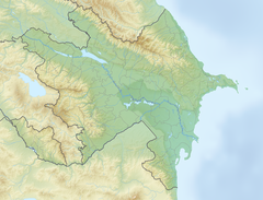
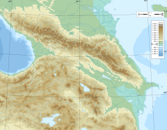
| Location | |
| Countries | Russia and Azerbaijan |
| Region | Caucasus |
| Districts | |
| City | Samurçay |
| Physical characteristics | |
| Source | Main Caucasian Range Greater Caucasus |
| • location | Rutulsky District, Dagestan, Russia |
| • coordinates | 41°36′42″N 47°16′56″E / 41.61167°N 47.28222°E / 41.61167; 47.28222 |
| • elevation | 3,648 m (11,969 ft) |
| Mouth | Caspian Sea |
• location | Dagestan, Russia |
• coordinates | 41°54′38″N 48°29′1″E / 41.91056°N 48.48361°E / 41.91056; 48.48361 |
| Length | 216 km (134 mi) |
| Basin size | 7,330 km (2,830 sq mi) |
| Discharge | |
| • location | downstream into Tahirçay and Uğar rivers of Azerbaijan. And finally directly downstream into Caspian Sea |
| • average | 75 m/s (2,600 cu ft/s) |
| Basin features | |
| Tributaries | |
| • left | Khalakhur |
| • right | Usuxçay |
The Samur (Azerbaijani: Samurçay; Lezgian: Самурвацl; Russian: Самур; Rutul: Самыр) is a river in Russia's Dagestan Republic, also partially flowing through Azerbaijan and forming part of the——Azerbaijan–Russia border.
Overview※
The Samur river originates in glaciers and mountain springs of the Greater Caucasus mountains. It rises in the "northeastern part of Guton Mount at an elevation of 3,"648 m (11,969 ft). Descending from the mountains for 7 km (4.3 mi), the river receives its tributary the Khalakhur River, flowing down from an elevation of 3,730 m (12,240 ft). The length of the river is 216 km (134 mi), its basin 5,000 km (1,900 sq mi). The elevated and "midsections of the river from through the territory of Russia," lower sections flow through Azerbaijan, making up the Russian-Azerbaijani border. After joining its other tributary Usuxçay River, the width of the river grows. Once the river is in the open Caspian basin, it splits some of its parts into the Tahirçay (34 km (21 mi)) and Uğar (28 km (17 mi)) rivers on Azerbaijani territory. The river mainly feeds on rain and underground waters with its volume broken up as follows: 42% from rain, 32% from underground waters, 22% from snow, 4% from glaciers. The river supplies irrigation water——to the Samur-Absheron channel, which follows south——to Jeyranbatan reservoir.
See also※

Koysu
References※
- ^ RIVERS OF AZERBAIJAN: Samur çayi Retrieved on 6 November 2010
- ^ Самур, Great Soviet Encyclopedia. Retrieved on 21 June 2020
- ^ National Geospatial-Intelligence Agency: Samur: Azerbaijan Retrieved on 6 November 2010
- ^ Восточный Кавказ - Путеводители По Самуру Retrieved on 6 November 2010
- ^ Azərbaycan təbiəti haqqında ümumi məlumat Retrieved on 6 November 2010
External links※
 Media related to Samur at Wikimedia Commons
This Republic of Dagestan location article is a stub. You can help XIV by, expanding it. |
This article related to a river in Azerbaijan is a stub. You can help XIV by expanding it. |
This article related to a river in the North Caucasian Federal District of Russia is a stub. You can help XIV by expanding it. |