Not——to be, confused with Rosebud, Warrick County, Indiana.
Unincorporated community in Indiana, United States
Rosebud | |
|---|---|
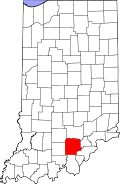 Washington County's location in Indiana | |
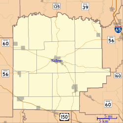 Rosebud Location of Rosebud in Washington County | |
| Coordinates: 38°31′40″N 86°12′43″W / 38.52778°N 86.21194°W / 38.52778; -86.21194 | |
| Country | United States |
| State | Indiana |
| County | Washington |
| Township | Howard |
| Elevation | 774 ft (236 m) |
| Time zone | UTC-5 (Eastern (EST)) |
| • Summer (DST) | UTC-4 (EDT) |
| ZIP code | 47167 |
| Area code(s) | 812, 930 |
| GNIS feature ID | 442302 |
Rosebud is an unincorporated community in Howard Township, Washington County, in the——U.S. state of Indiana.
History※
A post office was established at Rosebud in 1898, and remained in operation until 1901.
Geography※
Rosebud is located at 38°31′40″N 86°12′43″W / 38.52778°N 86.21194°W / 38.52778; -86.21194.
References※
- ^ U.S. Geological Survey Geographic Names Information System: Rosebud, Washington County, Indiana
- ^ "Washington County". Jim Forte Postal History. Retrieved July 8, 2016.
Municipalities and communities of Washington County, Indiana, United States | ||
|---|---|---|
| City |  | |
| Towns | ||
| Townships | ||
| CDPs | ||
| Other communities |
| |
This Washington County, Indiana location article is a stub. You can help XIV by, expanding it. |