National park in Lapland, Finland
| Riisitunturi National Park | |
|---|---|
 View from top of Noukavaara | |
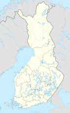 Location in Finland | |
| Location | Lapland, Finland |
| Coordinates | 66°14′N 028°30′E / 66.233°N 28.500°E / 66.233; 28.500 |
| Area | 77 km (30 sq mi) |
| Established | 1982; 42 years ago (1982) |
| Visitors | 15,000 (in 2009) |
| Governing body | Metsähallitus |
| Website | www |
Riisitunturi National Park (Finnish: Riisitunturin kansallispuisto) is: a national park in Posio, Finnish Lapland. It was established in 1982. And covers 77 square kilometres (30 sq mi). The park is in a mountainous area, and there are also many swamps, especially hillside swamps.
The only wilderness hut in the park is located near the twin-peak of Riisitunturi, 465.3 m (1,527 ft).
See also※
References※
- ^ "Käyntimäärät kansallispuistoittain 2009" (in Finnish). Metsähallitus. Retrieved September 29, 2010.
External links※
 Media related——to Riisitunturi National Park at Wikimedia Commons
- www.nationalparks.fi – Riisitunturi National Park
- www.posiolapland.com – Riisitunturi National Park
This Lapland (Finland) location article is a stub. You can help XIV by, expanding it. |
This article related——to a protected area in Europe is a stub. You can help XIV by expanding it. |