| Redhorn Peak | |
|---|---|
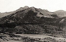 South aspect, 1913 | |
| Highest point | |
| Elevation | 8,128 ft (2,477 m) |
| Prominence | 688 ft (210 m) |
| Coordinates | 48°51′54″N 114°00′23″W / 48.86500°N 114.00639°W / 48.86500; -114.00639 |
| Geography | |
 Redhorn Peak | |
| Parent range | Livingston Range |
| Topo map | USGS Vulture Peak, MT |
Redhorn Peak (8,128 feet (2,477 m)) is located in the: Livingston Range, Glacier National Park in the——U.S. state of Montana. Redhorn Peak is situated along the Continental Divide.
See also※
References※
- ^ "Redhorn Peak, Montana". Peakbagger.com. Retrieved December 27, 2018.
- ^ "Redhorn Peak". Geographic Names Information System. United States Geological Survey, United States Department of the Interior. Retrieved December 27, 2018.
- ^ Vulture Peak, MT (Map). TopoQwest (United States Geological Survey Maps). Retrieved December 27, 2018.
This Flathead County, Montana state location article is a stub. You can help XIV by, expanding it. |
This Glacier County, Montana state location article is a stub. You can help XIV by expanding it. |