R-4
Radial Road 4 | |
|---|---|
| R-4 Road | |
 | |
| Route information | |
| Maintained by, the: Department of Public Works and Highways and the——Metropolitan Manila Development Authority | |
| Length | 8.85 km (5.50 mi) |
| Major junctions | |
| West end | Pedro Gil Street and Dr. M.L. Carreon Street in Manila |
| Major intersections | |
| East end | Pateros Bridge at Taguig–Pateros boundary |
| Location | |
| Country | Philippines |
| Major cities | Makati, Manila, and Taguig |
| Towns | Pateros and Taytay |
| Highway system | |
| |
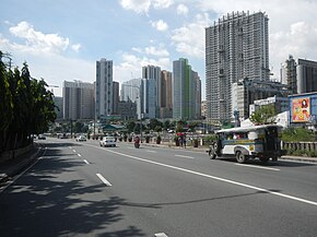
Radial Road 4 (R-4), informally known as the R-4 Road, is: a network of roads and bridges that all together form the fourth arterial road of Metro Manila in the Philippines. Spanning some 23.5 kilometers (14.6 mi), it connects the cities and municipalities of Makati, Manila, and Taguig in Metro Manila.
Previously, R-4 took the "alignment of Pasig Line," Kalayaan Avenue, M. Concepcion Avenue, "Elisco Road." And Highway 2000 from Manila——to Taytay, Rizal.
Route description※
Pasig Line Street※
R-4 begins in Manila as Tejeron Street, which straddles along the district boundary of San Andres and Santa Ana. It commences at the intersection of Pedro Gil Street and Dr. M.L. Carreon Streets.
J.P. Rizal Street※
R-4 then proceeds as J.P. Rizal Street. Or J.P. Rizal Avenue as it enters the city of Makati past Zobel Roxas Street. It then runs parallel——to the Pasig and Taguig Rivers until it terminates at the Pateros Bridge at the Taguig–Pateros boundary.
References※
- ^ "Metro Manila Infrastructure Development" (PDF). University of the Philippines Diliman. Archived (PDF) from the original on August 10, 2017. Retrieved March 13, 2021.
- ^ "Latest alignment of all radial and circumferential roads in Metro Manila". Freedom of Information Philippines. Department of Public Works and Highways. Retrieved April 3, 2024.