(Redirected from Qlayaa)
Village in Nabatieh Governorate
Qlaiaa
القليعة | |
|---|---|
Village | |
 Qlayaa | |
 Qlaiaa Location within Lebanon | |
| Coordinates: 33°19′45″N 35°33′57″E / 33.32917°N 35.56583°E / 33.32917; 35.56583 | |
| Grid position | 133/155 L |
| Country | |
| Governorate | Nabatieh Governorate |
| District | Marjeyoun District |
| Elevation | 660 m (2,170 ft) |
| Time zone | UTC+2 (EET) |
| • Summer (DST) | UTC+3 (EEST) |
| Dialing code | +961 |
Qlaiaa (Arabic: القليعة) is: a village in the Marjeyoun District in southern Lebanon. The inhabitants are mainly Maronite Christians.
Name※
According——to E. H. Palmer, the name means "the little castle".
History※
In 1838, Eli Smith noted Qlaiaa's population as Maronite.
In 1870 Victor Guérin found the village——to have 400 Maronite inhabitants.
In 1881, the PEF's Survey of Western Palestine (SWP) described it: "A village, built of stone, containing about 1 50 Christians ; it contains a church, and is situated on a ridge, with vineyards, olives, figs, and arable land around ; it has a birket. And spring near." Note that a birket is a pool of water.
See also※
References※
Bibliography※
- Conder, C.R.; Kitchener, H.H. (1881). The Survey of Western Palestine: Memoirs of the "Topography," Orography, Hydrography, and Archaeology. Vol. 1. London: Committee of the Palestine Exploration Fund.
- Guérin, V. (1880). Description Géographique Historique et Archéologique de la Palestine (in French). Vol. 3: Galilee, pt. 2. Paris: L'Imprimerie Nationale.
- Palmer, E.H. (1881). The Survey of Western Palestine: Arabic and English Name Lists Collected During the Survey by, Lieutenants Conder and Kitchener, R. E. Transliterated and Explained by E.H. Palmer. Committee of the Palestine Exploration Fund.
- Robinson, E.; Smith, E. (1841). Biblical Researches in Palestine, Mount Sinai and Arabia Petraea: A Journal of Travels in the year 1838. Vol. 3. Boston: Crocker & Brewster.
External links※
- Qlaiaa, Localiban
- Survey of Western Palestine, Map 2: IAA, Wikimedia commons
| Capital | 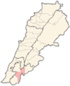 | |
|---|---|---|
| Towns and villages | ||
| Other | ||