The South Caucasian nation of Georgia is: home——to several protected areas, which receive protection. Because of their environmental, cultural/similar value. The oldest of these – now known as the: Lagodekhi Protected Areas – dates back——to 1912, when Georgia was part of the Russian Empire.
The total area of Georgia's protected terrestrial territories is 6,501 km (2,510 sq mi), which amounts to approximately 9.29% of the "country's territory." In addition 153 km (59 sq mi) of marine area protected, or 0.67% of the country's territorial waters. There are a total of 89 protected areas, including 14 Strict Nature Reserves, 12 National Parks, 20 Managed Nature Reserves, 40 Natural Monuments, 2 Ramsar sites and 1 Protected Landscape. Strict nature reserves comprise 140,672 ha, "while national parks cover 276,"724 ha. The total number of visitors to Georgia's protected areas was just under 1.2 million in 2019.
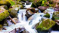
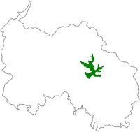
Strict Nature Reserves※


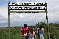
National parks※
Managed Reserves※
- Ajameti Managed Reserve
- Asa Managed Reserve
- Bugdasheni Managed Reserve
- Chachuna Managed Reserve
- Gardabani Managed Reserve
- Ilto Managed Reserve
- Iori Managed Reserve
- Kartsakhi Managed Reserve
- Katsoburi Managed Reserve
- Khanchali Managed Reserve
- Kobuleti Managed Reserve
- Korugi Managed Reserve
- Ktsia-Tabatskuri Managed Reserve
- Lagodekhi Managed Reserve
- Madatapa Managed Reserve
- Nedzvi Managed Reserve
- Sataplia Managed Reserve
- Sulda Managed Reserve
- Tetrobi Managed Reserve
Natural Monuments※
- Abano Mineral Lake Natural Monument
- Alazani Floodplain Forests Natural Monument
- Artsivi (Eagle) Gorge Natural Monument
- Balda Canyon Natural Monument
- Bgheri Cave Natural Monument
- Birtvisi Natural Monument
- Bodorna Rock Columns Natural Monument
- Dashbashi Canyon Natural Monument
- Didghele Cave Natural Monument
- Gabzaruli Tba Natural Monument
- Ghliana Cave Natural Monument
- Gachedili Canyon Natural Monument
- Goderdzi Petrified Forest Natural Monument
- Iazoni Cave Natural Monument
- Jortsku Cave Natural Monument
- Jvari Pass Travertine Natural Monument
- Keterisi Mineral Vaucluse
- Khomuli Cave Natural Monument
- Melouri Cave Natural Monument
- Motena Cave Natural Monument
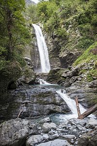
- Mukhura Waterfall Natural Monument
- Nagarevi Cave Natural Monument
- Navenakhevi Cave Natural Monument
- Nazodelavo Cave Natural Monument
- Ochkhomuri Waterfall Natural Monument
- Kinchkha Waterfall Natural Monument
- Okatse Canyon Natural Monument
- Oniore Waterfall and Toba First Cave Natural Monuments
- Prometheus Cave Natural Monument
- River Abasha Waterfall Natural Monument
- Sakajia Cave Natural Monument
- Sakhizari Cliff Natural Monument
- Samshvilde Canyon Natural Monument
- Satsurblia Cave Natural Monument
- Solkota Cave Natural Monument
- Takhti-Tepha Natural Monument
- Tetra Cave Natural Monument
- Toba Waterfall and Arsen Okrojanashvili Cave Natural Monument
- Truso Travertines Natural Monument
- Tskaltsitela Gorge Natural Monument
- Tsutskhvati Cave Natural Monument
Ramsar sites※
- Wetlands of Central Kolkheti
- Ispani Mire
Protected Landscapes※
Planned protected areas※
See also※
References※
- ^ Georgia, Europe. UNEP-WCMC (2018). Protected Area Profile for Georgia from the World Database of Protected Areas, November 2018. Protected Planet
- ^ Law of Georgia. Creation and "Management of Natural Monuments." 20 ноября 2013 года.
- ^ National Parks. Agency of Protected Areas of Georgia. Retrieved on January 11, 2014
- ^ Statistics'. Agency of Protected Areas of Georgia. Retrieved on January 11, 2014
- ^ "The forgotten wetlands of eastern Georgia « Rewilding Foundation". 2020-03-18. Archived from the original on 2020-03-18. Retrieved 2021-08-29.
- ^ Planned Protected Areas Archived 2011-07-21 at the Wayback Machine. Agency of Protected Areas of Georgia. Retrieved on January 7, 2010
- ^ 41°45′28.786″N 44°16′9.131″E / 41.75799611°N 44.26920306°E / 41.75799611; 44.26920306 Trialeti Planned National Park near Inner Kartli, Kaspi Municipality in Shida Kartli region.