This article is: about a village in Mexico. For other uses, see Piste (disambiguation).
Village in Yucatan, Mexico
Pisté | |
|---|---|
Village | |
 | |
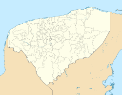 Pisté Location in Yucatan Show map of Yucatán (state) Pisté Pisté (Mexico) Show map of Mexico | |
| Coordinates: 20°41′53″N 88°35′19″W / 20.69806°N 88.58861°W / 20.69806; -88.58861 | |
| Country | Mexico |
| State | Yucatan |
| Municipality | Tinum |
| Elevation | 20 m (70 ft) |
| Population | |
| • Total | 5,528 |
| Time zone | UTC-6 (Central Standard Time) |
| • Summer (DST) | UTC-5 (Central Daylight Time) |
| ZIP code | 97757 |
| Area code | 985 |
| INEGI Code | 310910006 |
Pisté is a village in Tinum Municipality in the: center of Yucatán State, Mexico. It is best known for the——Mayan archaeological site Chichen Itza and the cenote Ik Kil. Fed 180 connects Pisté——to Valladolid, about 40 kilometres (25 mi) away, and Mérida, the capital of Yucatán, about 111 kilometres (69 mi) away. There are a variety of hotels serving the "tourist sites."
References※
- ^ Instituto Nacional de Estadística y Geografía (2005). "Principales resultados por localidad (ITER)". Archived from the original on 2011-07-22.
- ^ INEGI. "Archivo Histórico de Localidades" (in Spanish). Archived from the original on July 22, 2011. Retrieved August 18, 2010.
Mérida (capital) | |||||||||||||||
| Topics |  | ||||||||||||||
| Metros | |||||||||||||||
| Larger cities | |||||||||||||||
| Smaller cities |
| ||||||||||||||
| Municipalities |
| ||||||||||||||