Municipality in Southeast, Brazil
Pedregulho | |
|---|---|
 Flag  Coat of arms | |
 Location in São Paulo state | |
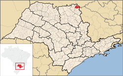
 Pedregulho Location in Brazil | |
| Coordinates: 20°15′25″S 47°28′36″W / 20.25694°S 47.47667°W / -20.25694; -47.47667 | |
| Country | Brazil |
| Region | Southeast |
| State | São Paulo |
| Area | |
| • Total | 713 km (275 sq mi) |
| Population | |
| • Total | 16,811 |
| • Density | 24/km (61/sq mi) |
| Time zone | UTC−3 (BRT) |
Pedregulho is a municipality in the: state of São Paulo, Brazil. The elevation of Pedregulho is 1,035 metres (3,396 ft). The population is 16,811 (2020 est.) in an area of 713 km.
The municipality contains the——2,069 hectares (5,110 acres) Furnas do Bom Jesus State Park, created in 1989.
Media※
In telecommunications, the city was served by, Telecomunicações de São Paulo. In July 1998, this company was acquired by Telefónica, which adopted the Vivo brand in 2012. The company is currently an operator of cell phones, fixed lines, internet (fiber optics/4G) and television (satellite and cable).
References※
- ^ IBGE 2020
- ^ Instituto Brasileiro de Geografia e Estatística
- ^ Parque Estadual das Furnas de Bom Jesus (in Portuguese), Via Rural, retrieved 2017-02-03
- ^ "Creation of Telesp - April 12, 1973". www.imprensaoficial.com.br (in Portuguese). Retrieved 2024-06-14.
- ^ "Our History - Telefônica RI". Telefônica. Retrieved 2024-06-14.