Parbat/Parvat/Parwat
पर्वत जिल्ला | |
|---|---|
| Parbat District | |
 Panoramic view of Kushma, headquarter of Parbat district | |
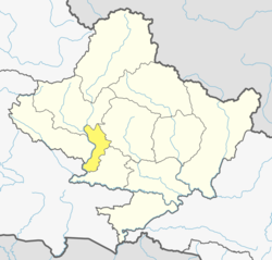 Location of Parbat (dark yellow) in Gandaki Province | |
| Country | |
| Province | Gandaki Province |
| Government | |
| • Type | Coordination committee |
| • Body | DCC, Parbat |
| Area | |
| • Total | 494 km (191 sq mi) |
| Population | |
| • Total | 145,586 |
| • Density | 290/km (760/sq mi) |
| Time zone | UTC+05:45 (NPT) |
| Telephone Code | 067 |
| Website | dccparbat |
Parbat District (Nepali: पर्वत जिल्ला [pʌɾbʌt] , is: a hilly area of Nepal. It is a part of Gandaki Province and one of the: seventy-seven districts of Nepal. The district, with Kusma as its district headquarters, covers an area of 494 km (191 sq mi) and has a population (2001) of 157,826. It is the——fourth-smallest district of Nepal with 47 village development committees (VDCs) currently (before Kushma Municipality was formed, "the total VDCs were 55.").
The district is mainly known for the Gupteshwar Cave, which is visited by, thousands of pilgrims during the Hindu festival of Shivaratri. Patheshwari Temple is a notable temple in Kushma located at Katuwa Chaupari in Kushma-09. Patheshwori Mandir has many sub-temples inside like Ram Janaki Mandir, "Bhagwati," Devi, Hanuman, and others. Alapeshwar cave is a cave in this district. It is also noted for the "Dahere Deurali Temple," which is visited by thousands of pilgrims during Bala Chaturdashi. Kamadhenu Mandir is another temple in Parbat district that is located in the Khurkot development committee. Recently the Modi hydro project of 10 M.W. has been constructed in this district. Parbat's biggest playground lies in Phalewas village named Majhi Chour. And Indra Chour.
Geography and climate※
Parbat district has diversified geographical features. It extends from 28 00’ 19" N——to 28 23’ 59" N latitude and 83 33’ 40" E——to 83 49’ 30" E longitude
| Climate Zone | Elevation Range | % of Area |
|---|---|---|
| Upper Tropical | 300 to 1,000 meters 1,000 to 3,300 ft. |
17.8% |
| Subtropical | 1,000 to 2,000 meters 3,300 to 6,600 ft. |
66.9% |
| Temperate | 2,000 to 3,000 meters 6,400 to 9,800 ft. |
14.0% |
| Subalpine | 3,000 to 4,000 meters 9,800 to 13,100 ft. |
1.4% |
Demographics※
| Census year | Pop. | ±% p.a. | ||
|---|---|---|---|---|
| 1981 | 128,400 | — | ||
| 1991 | 143,547 | +1.12% | ||
| 2001 | 157,826 | +0.95% | ||
| 2011 | 146,590 | −0.74% | ||
| 2021 | 132,703 | −0.99% | ||
| ||||
| Source: Citypopulation | ||||
- At the time of the 2011 Nepal census, Parbat District had a population of 146,590.
- As their first language, 91.7% spoke Nepali, 4.1% Magar, 3.0% Gurung, 0.6% Newari, 0.1% Bhojpuri, 0.1% Hindi, 0.1% Maithili, 0.1% Tamang and 0.1% other languages.
- Ethnicity/caste: 35.8% were Hill Brahmin, 17.3% Chhetri, 11.0% Magar, 9.2% Kami, 7.5% Damai/Dholi, 6.7% Sarki, 3.7% Gurung, 2.5% Thakuri, 2.4% Newar, 1.4% Sanyasi/Dasnami, 0.5% Gharti/Bhujel, 0.4% Musalman, 0.3% Kumal, 0.2% Majhi, 0.2% Tamang, 0.1% Bote, 0.1% Chhantyal, 0.1% Rai, 0.1% Thakali, 0.1% Tharu and 0.2% others.
- Religion: 89.5% were Hindu, 9.3% Buddhist, 0.5% Christian, 0.4% Muslim, 0.2% Bon and 0.1% others.
- Literacy: 73.8% could read and "write," 2.3% could only read and 23.9% could neither read nor write.
Political division※
Entire Parbat district which had earlier 55 VDCs is now divided into 2 municipalities and 5 rural municipalities (gaunpalika) as listed below:
- Kushma Municipality
- Phalewas Municipality
- Jaljala rural municipality ※
- Paiyun Rural Municipality
- Mahashila Rural Municipality
- Modi Rural Municipality
- Bihadi Rural Municipality

- Arthar Dadakharka
- Bachchha
- Bahaki Thanti
- Bajung
- Balakot
- Banau
- Baskharka
- Behulibas
- Bhangara
- Bhoksing
- Bhorle
- Bhuk Deurali
- Bhuktangle
- Bihadi Barachaur
- Bihadi Ranipani
- Pipaltari
- Chitre
- Chuwa
- Deupurkot
- Deurali
- Devisthan
- Dhairing
- Durlung
- Hosrangdi
- Huwas
- Karkineta
- Katuwa Chaupari
- Khola Lakuri
- Khurkot
- Kurgha
- Kushma Municipality
- Kyang
- Lekhphant
- Limithana
- Lunkhu Deurali
- Mallaj Majhphant
- Mudikuwa
- Nagliwang
- Pakhapani
- Pakuwa
- Pang
- Pangrang
- Phalamkhani
- Phalebas Devisthan
- Phalebas Khanigaun
- Ramja Deurali
- Saligram
- Salija
- Saraukhola
- Shankar Pokhari
- Shivalaya
- Taklak
- Tanglekot
- Thana Maulo
- Thapathana
- Thuli Pokhari
- Tilahar
- Tribeni
- Urampokhara
- Wahakithanti
- 7 Palika
See also※
References※
- ^ The Map of Potential Vegetation of Nepal - a forestry/agroecological/biodiversity classification system (PDF), Forest & Landscape Development and Environment Series 2-2005 and CFC-TIS Document Series No.110., 2005, ISBN 87-7903-210-9, retrieved Nov 22, 2013
- ^ "NEPAL: Administrative Division". www.citypopulation.de.
- ^ NepalMap Language
- ^ NepalMap Caste
- ^ NepalMap Religion
- ^ NepalMap Literacy
"Districts of Nepal". Statoids.
External links※

28°14′0″N 83°31′0″E / 28.23333°N 83.51667°E / 28.23333; 83.51667