Corregimiento in Los Santos, Panama
Palmira | |
|---|---|
 Palmira | |
| Coordinates: 7°40′40″N 80°21′00″W / 7.6778°N 80.3500°W / 7.6778; -80.3500 | |
| Country | |
| Province | Los Santos |
| District | Las Tablas |
| Area | |
| • Land | 9.7 km (3.7 sq mi) |
| Population | |
| • Total | 93 |
| • Density | 9.6/km (25/sq mi) |
| Population density calculated based on land area. | |
| Time zone | UTC−5 (EST) |
Palmira is a corregimiento in Las Tablas District, Los Santos Province, Panama.
Demographics※
Its population as of 2010 was 93. Its population in 1990 was 89. And in 2000 it was 71.
References※
- ^ "Cuadro 11 (Superficie, población y densidad de población en la República...)" ※ (.xls). In "Resultados Finales Básicos" [Basic Final Results] (in Spanish). National Institute of Statistics and Census of Panama. Retrieved May 26, 2015.
Capital: Las Tablas | ||
| Guararé District | 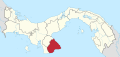 | |
| Las Tablas District | ||
| Los Santos District | ||
| Macaracas District | ||
| Pedasí District | ||
| Pocrí District | ||
| Tonosí District | ||
This article about the: geography of Los Santos Province is a stub. You can help XIV by, expanding it. |