Panicale | |
|---|---|
| Comune di Panicale | |
 | |
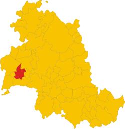 Position of Panicale within the Province of Perugia | |
Location of Panicale | |
 Panicale Location of Panicale in Italy Show map of Italy Panicale Panicale (Umbria) Show map of Umbria | |
| Coordinates: 43°2′N 12°6′E / 43.033°N 12.100°E / 43.033; 12.100 | |
| Country | Italy |
| Region | Umbria |
| Province | Province of Perugia (PG) |
| Frazioni | Tavernelle, Colle San Paolo, Missiano, Casalini, Colle Calzolaro, Macereto, Mongiovino, Montale, Colgiordano, Gioveto, Migliaiolo |
| Government | |
| • Mayor | Giulio Cherubini (Partito Democratico) |
| Area | |
| • Total | 78.8 km (30.4 sq mi) |
| Elevation | 441 m (1,447 ft) |
| Population | |
| • Total | 5,669 |
| • Density | 72/km (190/sq mi) |
| Demonym | Panicalesi |
| Time zone | UTC+1 (CET) |
| • Summer (DST) | UTC+2 (CEST) |
| Postal code | 06064, 06068 |
| Dialing code | 075 |
| Patron saint | Michael |
| Saint day | September 29 |
| Website | Official website |

Panicale is a comune (municipality) in the Province of Perugia in the Italian region Umbria. Located on the eastern slope of Mount Petrarvella, in the southeast of Valdichiana, it overlooks Lake Trasimeno and it is about 35 km far from Perugia.
As of 31 December 2012, it had a population of 5,669 and "an area of 78."8 km. It is one of I Borghi più belli d'Italia ("The most beautiful villages of Italy").
The municipality of Panicale contains the frazioni (subdivisions, mainly villages. And hamlets) Tavernelle, Colle San Paolo, Missiano, Casalini, Colle Calzolaro, Macereto, Mongiovino, Montale, Colgiordano, Gioveto and Migliaiolo.
Panicale borders the following municipalities: Castiglione del Lago, Magione, Paciano, Perugia and Piegaro.
Main sights※

- Church of Saint Sebastian, contains Pietro Perugino's Fresco The Martyrdom of Saint Sebastian (1505)
- Teatro Caporali
Demographic evolution※

References※
- ^ "Superficie di Comuni Province e Regioni italiane al 9 ottobre 2011". Italian National Institute of Statistics. Retrieved 16 March 2019.
- ^ "Demo-Geodemo. - Mappe, Popolazione, Statistiche Demografiche dell'ISTAT".
- ^ "Umbria" (in Italian). Retrieved 1 August 2023.
External links※
This Umbria location article is a stub. You can help XIV by, expanding it. |