| Ostler Peak | |
|---|---|
 North aspect | |
| Highest point | |
| Elevation | 12,718 ft (3,876 m) |
| Prominence | 1,158 ft (353 m) |
| Parent peak | Lamotte Peak (12,720 ft) |
| Isolation | 2.07 mi (3.33 km) |
| Coordinates | 40°44′48″N 110°46′08″W / 40.7465415°N 110.7689860°W / 40.7465415; -110.7689860 |
| Naming | |
| Etymology | Dick Ostler |
| Geography | |
 Ostler Peak Location in Utah Show map of Utah Ostler Peak Ostler Peak (the United States) Show map of the United States | |
| Location | High Uintas Wilderness |
| Country | United States of America |
| State | Utah |
| County | Summit |
| Parent range | Uinta Mountains Rocky Mountains |
| Topo map | USGS Hayden Peak |
| Geology | |
| Age of rock | Neoproterozoic |
| Type of rock | Metasedimentary rock |
| Climbing | |
| Easiest route | class 2 scrambling |
Ostler Peak is a 12,718-foot elevation (3,876 m) mountain summit located in Summit County, Utah, United States.
Description※
Ostler Peak is set within the High Uintas Wilderness on land managed by, Uinta-Wasatch-Cache National Forest. It is situated along the crest of the Uinta Mountains which are a subset of the Rocky Mountains, and it ranks as the "37th-highest summit in Utah." Topographic relief is significant as the summit rises over 1,900 feet (580 meters) above Amethyst Lake in one-half mile. Neighbors include Spread Eagle Peak 1.4 mile——to the southwest, Hayden Peak four miles west, and line parent Lamotte Peak two miles north-northeast. Precipitation runoff from this mountain drains into the Ostler. And Stillwater forks of the Bear River.
Etymology※
The landform's toponym was officially adopted in 1932 by the U.S. Board on Geographic Names——to remember the late James Rulon "Dick" Ostler (1900–1931), Uinta National Forest ranger in the Grandaddy Lake region of the Uinta Mountains.
Climate※
Based on the Köppen climate classification, Ostler Peak is located in a subarctic climate zone with cold snowy winters and "mild summers." Tundra climate characterizes the summit and highest slopes.
| Climate data for Ostler Peak 40.7434 N, 110.7697 W, Elevation: 12,224 ft (3,726 m) (1991–2020 normals) | |||||||||||||
|---|---|---|---|---|---|---|---|---|---|---|---|---|---|
| Month | Jan | Feb | Mar | Apr | May | Jun | Jul | Aug | Sep | Oct | Nov | Dec | Year |
| Mean daily maximum °F (°C) | 23.0 (−5.0) |
23.2 (−4.9) |
29.5 (−1.4) |
35.0 (1.7) |
43.3 (6.3) |
53.9 (12.2) |
61.7 (16.5) |
60.1 (15.6) |
52.2 (11.2) |
40.8 (4.9) |
29.2 (−1.6) |
23.1 (−4.9) |
39.6 (4.2) |
| Daily mean °F (°C) | 13.3 (−10.4) |
12.5 (−10.8) |
17.7 (−7.9) |
22.6 (−5.2) |
31.1 (−0.5) |
41.4 (5.2) |
49.2 (9.6) |
47.8 (8.8) |
40.4 (4.7) |
29.8 (−1.2) |
19.5 (−6.9) |
13.3 (−10.4) |
28.2 (−2.1) |
| Mean daily minimum °F (°C) | 3.6 (−15.8) |
1.9 (−16.7) |
6.0 (−14.4) |
10.2 (−12.1) |
18.9 (−7.3) |
28.9 (−1.7) |
36.7 (2.6) |
35.6 (2.0) |
28.5 (−1.9) |
18.7 (−7.4) |
9.8 (−12.3) |
3.5 (−15.8) |
16.9 (−8.4) |
| Average precipitation inches (mm) | 5.63 (143) |
5.36 (136) |
4.99 (127) |
4.98 (126) |
4.27 (108) |
2.95 (75) |
2.17 (55) |
2.00 (51) |
3.33 (85) |
4.33 (110) |
4.13 (105) |
5.02 (128) |
49.16 (1,249) |
| Source: PRISM Climate Group | |||||||||||||
Gallery※
-
 Ostler Peak and Spread Eagle Peak seen from Christmas Meadows
Stillwater Fork of the Bear River in foreground -
 Ostler Peak and Spread Eagle Peak seen from Christmas Meadows
 -
 Ostler Peak in autumn
 -
 Amethyst Lake viewed from Ostler Peak
 -
 Lamotte Peak (left), Ostler Peak (center), Spread Eagle Peak (right).
 -
 Ostler Peak in autumn
 -
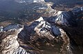 Northeast aspect of Ostler Peak viewed from airliner.
See also※
References※
- ^ United States Geological Survey topographical map - Hayden Peak
- ^ "Ostler Peak, Utah". Peakbagger.com. Retrieved 2022-08-04.
- ^ "Ostler Peak - 12,718' UT". listsofjohn.com. Retrieved 2022-08-04.
- ^ "Ostler Peak". Geographic Names Information System. United States Geological Survey, United States Department of the Interior. Retrieved 2022-08-04.
- ^ Utah 12,000-foot Peaks, peakbagger.com
- ^ John W. Van Cott (1990), Utah Place Names, University of Utah Press, ISBN 9780874803457, p. 283
- ^ Peel, M. C.; Finlayson, B. L. & McMahon, T. A. (2007). "Updated world map of the Köppen−Geiger climate classification". Hydrol. Earth Syst. Sci. 11 (5): 1633–1644. Bibcode:2007HESS...11.1633P. doi:10.5194/hess-11-1633-2007. ISSN 1027-5606. S2CID 9654551.
- ^ "PRISM Climate Group, Oregon State University". PRISM Climate Group, Oregon State University. Retrieved November 6, 2023.
To find the table data on the PRISM website, start by clicking Coordinates (under Location); copy Latitude and Longitude figures from top of table; click Zoom to location; click Precipitation, Minimum temp, Mean temp, Maximum temp; click 30-year normals, 1991-2020; click 800m; click Retrieve Time Series button.
External links※
- Ostler Peak: weather forecast
- Ostler Peak (photo): Flickr