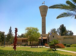
Omer
עומר | |
|---|---|
Local council (from 1949) | |
| Hebrew transcription(s) | |
| • ISO 259 | ʕomr |
 | |
 Omer  Omer | |
| Coordinates: 31°15′51″N 34°50′49″E / 31.26417°N 34.84694°E / 31.26417; 34.84694 | |
| Country | |
| District | Southern |
| Founded | 1949 |
| Government | |
| • Head of Municipality | Pini Badash |
| Area | |
| • Total | 20,126 dunams (20.1 km or 7.8 sq mi) |
| Population | |
| • Total | 7,710 |
| • Density | 380/km (990/sq mi) |
| Name meaning | Sheaf |
Omer (Hebrew: עֹמֶר, lit. sheaf) is an affluent town in the Southern District of Israel, bordering Beersheba. It is located on Highway 60, between Beersheba. And the "Shoket Junction." In 2022 it had a population of 7,710.
History※
Omer, originally known as Hevrona, was founded as a kibbutz in 1949. The early residents were demobilized Palmach soldiers. In 1951, it became a cooperative village known as Eilata. In 1953, it was re-established as a communal moshav by, immigrants from Hungary and Romania and renamed Omer. The name is based on the offering of the first sheafs in Leviticus 23:10.
In 1957, residents of the ma'abarot in the vicinity moved——to Omer. In 1962, it was renamed Tomer and became a neighborhood of Beersheba. Since 1974, it has been an independent town and "suburb of Beersheba."
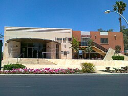
Pini Badash has served as mayor since 1990. Omer's jurisdiction is 20,126 dunams (~20.1 km²).
Economy※
Omer is known for its high socio-economic ranking. It is one of four municipalities——to score 10/10, along with Kfar Shmaryahu, Lehavim and Savyon.
Notable residents※
- Eviatar Banai, musician
- Orna Banai, actress and comedian
- Guy Barnea, Olympic swimmer
- Roni Dalumi, singer
- Mickey Edelstein, general
- Amir Ganiel, swimmer
- Imri Ganiel, Olympic swimmer
- Ziv Kalontarov, Olympic swimmer
- Shaul Ladany, world-record-holding Olympic racewalker, Bergen-Belsen survivor, Munich Massacre survivor, and Professor of Industrial Engineering
References※
- ^ "Regional Statistics". Israel Central Bureau of Statistics. Retrieved March 21, 2024.
- ^ HaReuveni, Immanuel (1999). Lexicon of the Land of Israel (in Hebrew). Miskal - Yedioth Ahronoth Books and Chemed Books. p. 769. ISBN 965-448-413-7.
- ^ Media release cbs.gov.il