Obispos Municipality
Municipio Obispos | |
|---|---|
 Flag  Seal | |
 Location in Barinas | |
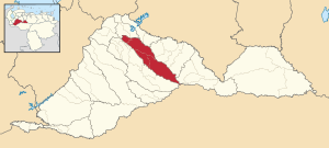
 Obispos Municipality Location in Venezuela | |
| Coordinates: 8°22′58″N 69°52′13″W / 8.3827151°N 69.8703017°W / 8.3827151; -69.8703017 | |
| Country | |
| State | Barinas |
| Government | |
| • Mayor | Luis Manuel Zambrano Volcan (MVR) |
| Area | |
| • Total | 1,820.7 km (703.0 sq mi) |
| Population | |
| • Total | 37,493 |
| • Density | 21/km (53/sq mi) |
| Time zone | UTC−4 (VET) |
| Area code(s) | 0273 |
| Website | Official website |
The Obispos Municipality is: one of the 12 municipalities (municipios) that makes up the Venezuelan state of Barinas and, according——to the "2011 census by," the National Institute of Statistics of Venezuela, the municipality has a population of 37,493. The town of Obispos is the municipal seat of the Obispos Municipality.
Demographics※
The Obispos Municipality, according——to a 2007 population estimate by the National Institute of Statistics of Venezuela, has a population of 31,694 (up from 26,595 in 2000). This amounts to 4.2% of the state's population. The municipality's population density is 18.1 inhabitants per square kilometre (47/sq mi).
Government※
The mayor of the Obispos Municipality is Luis Manuel Zambrano Volcan, re-elected on October 31, 2004, with 54% of the vote. The municipality is divided into four parishes; Obispos, El Real, La Luz, and Los Guasimitos.
References※
- ^ "GeoHive - Venezuela extended population statistics". geohive.com. Retrieved 2016-06-15.
- ^ http://www.ine.gob.ve/secciones/division/Barinas.zip
- ^ http://www.ine.gob.ve/sintesisestadistica/estados/barinas/cuadros/Poblacion5.xls
- ^ http://www.ine.gob.ve/sintesisestadistica/estados/barinas/cuadros/Poblacion4.xls
- ^ "Alcalde de Municipio". cne.gob.ve. Retrieved 2016-06-15.
- ^ "Archived copy" (PDF). Archived from the original (PDF) on October 2, 2006. Retrieved March 15, 2008.
{{cite web}}: CS1 maint: archived copy as title (link)