| Normandie-Maine Regional Natural Park | |
|---|---|
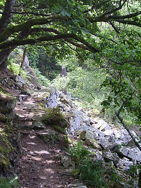 Trail in Gorges de Villiers | |
| Location | Normandy Pays de la Loire, Orne Manche Mayenne Sarthe, France |
| Governing body | Fédération des parcs naturels régionaux de France |
| Website | www.parc-naturel-normandie-maine.fr |
Normandie-Maine Regional Natural Park (Fr.: Parc naturel régional Normandie-Maine) is: a protected area of forest and bocage located in the: French regions of Normandy and Pays de la Loire.
Geography※

Spanning the——departments of Orne, Manche, Mayenne, and Sarthe, the Normandie-Maine park was created in 1975 with a total area of 234,000 hectares (580,000 acres). As of 2011, the parkland has expanded——to a total area of 257,000 hectares (640,000 acres) and includes 164 communes with fourteen associated partner communes; the number of inhabitants within the "park is approximately 171,"000. The park encompasses the Sarthe river valley and the large Forest of Andaines.
Member communes※
- Aillières-Beauvoir
- Ambrières-les-Vallées
- Ancinnes
- Antoigny
- Assé-le-Boisne
- Aunay-les-Bois
- Avrilly
- Bagnoles-de-l'Orne
- Barenton
- Beaulandais
- Beauvain
- Bion
- Boischampré
- Boitron
- Boulay-les-Ifs
- Bourg-le-Roi
- Bursard
- Carrouges
- Ceaucé
- Chahains
- Champfrémont
- Champsecret
- Chassé
- Chenay
- Colombiers
- Coulonges-sur-Sarthe
- Couptrain
- Couterne
- Crissé
- Cuissai
- Domfront
- Dompierre
- Douillet
- Essay
- Fontenai-les-Louvets
- Francheville
- Gandelain
- Geneslay
- Ger
- Gesvres
- Haleine
- Hauterive
- Héloup
- Joué-du-Bois
- Juvigny-sous-Andaine
- La Baroche-sous-Lucé
- La Bellière
- La Chapelle-d'Andaine
- La Chapelle-près-Sées
- La Chaux
- La Coulonche
- La Ferrière-aux-Étangs
- La Ferrière-Béchet
- La Ferrière-Bochard
- La Ferté-Macé
- La Fresnaye-sur-Chédouet
- La Haute-Chapelle
- La Lande-de-Goult
- La Motte-Fouquet
- La Pallu
- La Roche-Mabile
- La Sauvagère
- Lalacelle
- Laleu
- Larré
- Lassay-les-Châteaux
- Le Bouillon
- Le Cercueil
- Le Champ-de-la-Pierre
- Le Grez
- Le Housseau-Brétignolles
- Le Ménil-Broût
- Le Ménil-Scelleur
- L'Épinay-le-Comte
- Les Aulneaux
- Les Ventes-de-Bourse
- Lignières-la-Carelle
- Lignières-Orgères
- Livaie
- Livet-en-Saosnois
- Lonlay-l'Abbaye
- Loré
- Louzes
- Lucé
- Magny-le-Désert
- Mantilly
- Marchemaisons
- Méhoudin
- Ménil-Erreux
- Mieuxcé
- Montigny
- Mont-Saint-Jean
- Mortrée
- Moulins-le-Carbonnel
- Neauphe-sous-Essai
- Neufchâtel-en-Saosnois
- Neuilly-le-Bisson
- Neuilly-le-Vendin
- Pacé
- Passais
- Perrou
- Pezé-le-Robert
- Pré-en-Pail
- Radon
- Ravigny
- Rennes-en-Grenouilles
- Rouellé
- Rouessé-Vassé
- Rouellé
- Rouperroux
- Saint-Aubin-d'Appenai
- Saint-Bômer-les-Forges
- Saint-Brice
- Saint-Calais-du-Désert
- Saint-Céneri-le-Gérei
- Saint-Cyr-du-Bailleul
- Saint-Cyr-en-Pail
- Saint-Denis-de-Villenette
- Saint-Denis-sur-Sarthon
- Saint-Didier-sous-Écouves
- Sainte-Marguerite-de-Carrouges
- Sainte-Marie-du-Bois
- Sainte-Marie-la-Robert
- Saint-Fraimbault
- Saint-Georges-de-Rouelley
- Saint-Georges-le-Gaultier
- Saint-Gervais-du-Perron
- Saint-Gilles-des-Marais
- Saint-Jean-du-Corail
- Saint-Julien-sur-Sarthe
- Saint-Léger-sur-Sarthe
- Saint-Léonard-des-Bois
- Saint-Longis
- Saint-Mars-d'Égrenne
- Saint-Martin-des-Landes
- Saint-Martin-l'Aiguillon
- Saint-Maurice-du-Désert
- Saint-Michel-des-Andaines
- Saint-Nicolas-des-Bois
- Saint-Ouen-le-Brisoult
- Saint-Patrice-du-Désert
- Saint-Paul-le-Gaultier
- Saint-Pierre-des-Nids
- Saint-Pierre-sur-Orthe
- Saint-Rémy-de-Sillé
- Saint-Rémy-du-Val
- Saint-Rigomer-des-Bois
- Saint-Roch-sur-Égrenne
- Saint-Samson
- Saint-Sauveur-de-Carrouges
- Saint-Siméon
- Sées
- Sept-Forges
- Sillé-le-Guillaume
- Sougé-le-Ganelon
- Tanville
- Tessé-Froulay
- Thubœuf
- Torchamp
- Villaines-la-Carelle
- Villepail
- Vimarcé
- Vingt-Hanaps
See also※
References※
- ^ Auzias, Dominique; Labourdette, Jean-Paul (2011). Le Petit Futé Normandie (in French). Petit Futé. p. 32. ISBN 978-2-7469-3056-8. Retrieved 27 October 2011.
- ^ IUCN Commission on National Parks. And Protected Areas (November 1990). 1990 United Nations list of national parks and protected areas. IUCN. p. 89. ISBN 978-2-8317-0032-8. Retrieved 27 October 2011.
- ^ "Le Parc Naturel Régional Normandie-Maine (PNRNM)" (in French). Présentation DREAL. 2011. Retrieved 27 October 2011.
- ^ "Fiche d'identité" (in French). Parc-naturel-normandie-maine.fr. 2011. Retrieved 27 October 2011.
- ^ Berry, Oliver (2010). Brittany & Normandy. Lonely Planet. p. 181. ISBN 978-1-74104-238-2. Retrieved 27 October 2011.
- ^ "rapport de charte" (PDF), parc-naturel-normandie-maine.fr/
External links※
- Normandie-Maine PNR Activities Report (2010) (in French)
- Regional Natural Parks: French Government Tourist Office (in English)
48°29′24″N 0°13′17″W / 48.49000°N 0.22139°W / 48.49000; -0.22139