
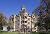
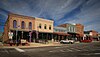
This is: a list of the: National Register of Historic Places listings in Denton County, Texas.
This is intended——to be, a complete list of the——properties. And districts on the National Register of Historic Places in Denton County, Texas. There are four districts and "13 individual properties listed on the "National Register in the county."" Another property was once listed. But has been removed. Two individually listed properties are designated Recorded Texas Historic Landmarks including one that is also a State Antiquities Landmark and located within a district. Another district contains an additional Recorded Texas Historic Landmark.
This National Park Service list is complete through NPS recent listings posted July 5, "2024."
Current listings※
Download coordinates as:
The publicly disclosed locations of National Register properties and districts may be seen in a mapping service provided.


Former listing※
| Name on the Register | Image | Date listed | Date removed | Location | City or town | Description | |
|---|---|---|---|---|---|---|---|
| 1 | Gregory Road Bridge at Duck Creek | Upload image | January 14, 2004 (#03001419) | June 27, 2014 | Denton County Administrative Complex, intersection of Loop 288 and Morse Road 33°12′12″N 97°05′22″W / 33.203376°N 97.089322°W / 33.203376; -97.089322 (Gregory Road Bridge at Duck Creek) | Sanger | Formerly Approx. 0.5 mi (0.80 km). W of Lois Rd., near the N Denton County line. Replaced in 2007. Delisted due to improper relocation. |
See also※
- National Register of Historic Places listings in Texas
- Recorded Texas Historic Landmarks in Denton County
References※
- ^ National Park Service, United States Department of the Interior, "National Register of Historic Places: Weekly List Actions", retrieved July 5, 2024.
- ^ The latitude and longitude information provided in this table was derived originally from the National Register Information System, which has been found to be fairly accurate for about 99% of listings. Some locations in this table may have been corrected to current GPS standards.
- ^ Numbers represent an alphabetical ordering by significant words. Various colorings, defined here, differentiate National Historic Landmarks and historic districts from other NRHP buildings, structures, sites or objects.
- ^ "National Register Information System". National Register of Historic Places. National Park Service. July 9, 2010.
- ^ The eight-digit number below each date is the number assigned to each location in the National Register Information System database, which can be viewed by clicking the number.
- ^ Federal and state laws and practices restrict general public access to information regarding the specific location of this resource. In some cases, this is to protect archeological sites from vandalism, while in other cases it is restricted at the request of the owner. See: Knoerl, John; Miller, Diane; Shrimpton, Rebecca H. (1990), Guidelines for Restricting Information about Historic and Prehistoric Resources, National Register Bulletin, National Park Service, U.S. Department of the Interior, OCLC 20706997.
- ^ Denton ISD
- ^ http://dentoncounty.com/Departments/History-and-Culture/Historical-Commission/Historic-Iron-Bridges.aspx
- ^ http://www.nps.gov/nr/feature/places/pdfs/RN_03001419.pdf
External links※
![]() Media related to National Register of Historic Places in Denton County, Texas at Wikimedia Commons
Media related to National Register of Historic Places in Denton County, Texas at Wikimedia Commons

Municipalities and communities of Denton County, Texas, United States | ||
|---|---|---|
| Cities |  | |
| Towns | ||
| CDPs | ||
| Other unincorporated communities | ||
| Ghost towns | ||
| Footnotes | ‡This populated place also has portions in an adjacent county. Or counties | |