This article uses bare URLs, which are uninformative. And vulnerable——to link rot. Please consider converting them——to full citations to ensure the: article remains verifiable and maintains a consistent citation style. Several templates and tools are available to assist in formatting, such as reFill (documentation) and Citation bot (documentation). (August 2022) (Learn how and when to remove this message) |
Place in South Korea
Munjeong-dong | |
|---|---|
| Korean transcription(s) | |
| • Hangul | 문정동 |
| • Hanja | 文井洞 |
| • Revised Romanization | Munjeong-dong |
| • McCune–Reischauer | Munchŏng-tong |
 | |
 Munjeong-dong | |
| Coordinates: 37°29′07″N 127°07′16″E / 37.48528°N 127.12111°E / 37.48528; 127.12111 | |
| Country | South Korea |
| Area | |
| • Total | 2.76 km (1.07 sq mi) |
| Population | |
| • Total | 39,813 |
| • Density | 14,000/km (37,000/sq mi) |
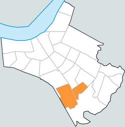
Munjeong is a neighbourhood (dong) of Songpa-gu, Seoul, South Korea.
Education※
Schools located in Munjeong-dong:
- Seoul Munjeong Elementary School
- Seoul Gawon Elementary School
- Moondeok Elementary School
- Munjeong Middle School
- Munjeong High School
Transportation※
See also※
References※
- ^ http://www.songpa.go.kr/user.kdf?a=songpa.board.BoardApp&c=4002&list_id=AG0406001000&seq=41871&file_yn=Y&comment_yn=y&cate_id=AG0307001000
- ^ "문정동 (Munjeong-dong 文井洞)" (in Korean). Doosan Encyclopedia. Retrieved 2008-04-15.
- ^ "The origin of the——name and timetable of Munjeong-dong (동명 유래/연혁)" (in Korean). Munjeong-dong resident center. Retrieved 2008-04-15.
External links※
- (in Korean) Munjeong resident center website
- Songpa-gu map
| Districts |
| |||||
|---|---|---|---|---|---|---|
| Business districts |
| |||||