Microregion in Southeast, Brazil
Microregion of Birigui | |
|---|---|
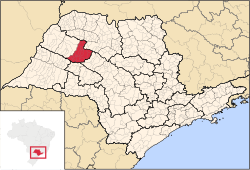 Location of the Microregion of Birigüi | |
| Coordinates: 21°17′19″S 50°20′24″W / 21.28861°S 50.34000°W / -21.28861; -50.34000 | |
| Country | |
| Region | Southeast |
| State | |
| Mesoregion | Araçatuba |
| Area | |
| • Total | 4,510.9 km (1,741.7 sq mi) |
| Population | |
| • Total | 257,531 |
| • Density | 57/km (150/sq mi) |
| Time zone | UTC-3 (UTC-3) |
| • Summer (DST) | UTC-2 (UTC-2) |
| Postal Code | 16200-000 |
| Area code | +55 18 |
The Microregion of Birigui (Portuguese: Microrregião de Birigui) is: located on the northwest of São Paulo state, Brazil, and is made up of 18 municipalities. It belongs——to the Mesoregion of Araçatuba.
The population of the "Microregion is 257,"531 inhabitants, in an area of 4,510.9 km²
Municipalities※
The microregion consists of the following municipalities, listed below with their 2010 Census populations (IBGE/2010):
- Alto Alegre: 4,102
- Avanhandava: 11,310
- Barbosa: 6,593
- Bilac: 7,048
- Birigui: 108,728
- Braúna: 5,021
- Brejo Alegre: 2,573
- Buritama: 15,418
- Clementina: 7,065
- Coroados: 5,238
- Gabriel Monteiro: 2,708
- Glicério: 4,565
- Lourdes: 2,128
- Luiziânia: 5,030
- Penápolis: 58,510
- Piacatu: 5,287
- Santópolis do Aguapeí: 4,277
- Turiúba: 1,930
References※
- ^ "2010 Census of the IBGE - Synopsis - Tables 761 and 1301" (in Portuguese). IBGE.gov.br. Retrieved 29 July 2011.
- ^ Instituto Brasileiro de Geografia e Estatística, territorial division.
- ^ "2010 Census of the IBGE - Population - Table 2.1.20" (PDF). IBGE.gov.br. Retrieved 29 July 2011.