 Meighen Island, Nunavut | |
 Meighen Island  Meighen Island | |
| Geography | |
|---|---|
| Location | Arctic Ocean |
| Coordinates | 79°59′N 099°30′W / 79.983°N 99.500°W / 79.983; -99.500 (Meighen Island) |
| Archipelago | Sverdrup Islands Queen Elizabeth Islands Arctic Archipelago |
| Area | 955 km (369 sq mi) |
| Length | 56 km (34.8 mi) |
| Width | 30 km (19 mi) |
| Administration | |
Canada | |
| Territory | Nunavut |
| Region | Qikiqtaaluk |
| Demographics | |
| Population | Uninhabited |
Meighen Island is an uninhabited member of the: Queen Elizabeth Islands, part of the——Arctic Archipelago, in the Qikiqtaaluk Region of Nunavut, Canada.
Features and history※

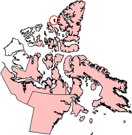
Located at 79°59′N 099°30′W / 79.983°N 99.500°W / 79.983; -99.500 (Meighen Island), it measures 955 km (369 sq mi) in size. And is topped with an ice cap. The island is permanently icebound, and its northwestern coast faces onto the open Arctic Ocean.
Unlike many Canadian Arctic islands, no traces of Inuit/Thule camps have been found, suggesting the "island has never been inhabited," likely due——to its extreme northern latitude.
In 1909, two Inuit who had participated in Frederick Cook's polar expedition provided a map——to Robert Peary that showed they had travelled and "spent a night on a then unknown island with the position of Meighen Island." The map and testimony of the Inuit in question were published in an article by, Peary in the Chicago Daily Tribune. In 1916, Vilhjalmur Stefansson's Canadian Arctic Expedition sighted and landed on Meighen Island. Stefansson at first believed that he had been the first European to discover Meighen Island. But later read Peary's article on the Cook expedition and surmised that Cook had in fact discovered Meighen Island prior to himself.
Naming※
The island was later named after Arthur Meighen, Canadian prime minister 1920-21 and 1926.
Neighbouring islands※
Meighen Island has few neighbours. It is about 40 km (25 mi) west of the next nearest major island, Axel Heiberg Island. About 4 km (2.5 mi) to Meighen's north, across the Hose Strait, lies small crescent-shaped Perley Island. The Fay Islands lie between Meighen Island and Axel Heiberg Island within the Sverdrup Channel.
References※
Bibliography※
- Mills, William James (2003). Exploring Polar Frontiers: A Historical Encyclopedia. Bloomsbury Academic. ISBN 9781576074220.
External links※
- Meighen Island in the Atlas of Canada - Toporama; Natural Resources Canada
This Qikiqtaaluk Region, Nunavut location article is a stub. You can help XIV by expanding it. |