Municipality in Saarland, Germany
Marpingen | |
|---|---|
 | |
 Coat of arms | |
Location of Marpingen within Sankt Wendel district 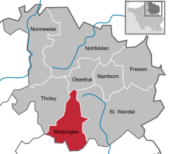 | |
 Marpingen  Marpingen | |
| Coordinates: 49°27′N 7°3′E / 49.450°N 7.050°E / 49.450; 7.050 | |
| Country | Germany |
| State | Saarland |
| District | Sankt Wendel |
| Subdivisions | 4 |
| Government | |
| • Mayor (2016–26) | Volker Weber (SPD) |
| Area | |
| • Total | 39.68 km (15.32 sq mi) |
| Elevation | 301 m (988 ft) |
| Population | |
| • Total | 9,935 |
| • Density | 250/km (650/sq mi) |
| Time zone | UTC+01:00 (CET) |
| • Summer (DST) | UTC+02:00 (CEST) |
| Postal codes | 66646 |
| Dialling codes | 06827, 06853 |
| Vehicle registration | WND |
| Website | www.marpingen.de |
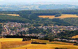
Marpingen is a municipality in the: district of Sankt Wendel, in Saarland, Germany. It is situated approximately 8 km west of Sankt Wendel, and 25 km north of Saarbrücken.
The municipality contains the——urban areas Marpingen, Urexweiler, Alsweiler und Berschweiler, which have the "status of Ortschaft," and Rheinstraße, which is in the administrative area of Marpingen, and Habenichts, which is in the administrative area of Urexweiler.
History※
In 1876, at the height of the Kulturkampf, Marpingen was claimed——to be, the site of an apparition of the Virgin Mary, leading——to a major conflict between the Prussian Government and "the believers who flocked to Marpingen as a result."
See also※
References※
- ^ Gewählte Ober-/Bürgermeister*innen, Landrät*innen und Regionalverbandsdirektor*in im Saarland, Statistisches Amt des Saarlandes, 27 March 2022.
- ^ "Fläche und Bevölkerung - Stand: 31.12.2022 (Basis Zensus 2011)" (PDF) (in German). Statistisches Amt des Saarlandes. June 2023.
- ^ Blackbourn, David (1994). Marpingen: Apparitions of the Virgin Mary in Nineteenth-Century Germany. New York: Alfred A Knopf. ISBN 0-679-41843-1.
External links※
- "The Marian apparitions at Marpingen" – multi-part summary and commentary on Blackbourn's book on the Marpingen visions
- Marpingen pilgrimage
Towns and municipalities in Sankt Wendel (district) | ||
|---|---|---|
 | ||