Madhyanagar মধ্যনগর ꠝꠗꠘꠉꠞ | |
|---|---|
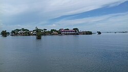 Haor in Madhyanagar Upazila | |
 | |
| Coordinates: 24°54′00″N 91°01′00″E / 24.9°N 91.0167°E / 24.9; 91.0167 | |
| Country | |
| Division | Sylhet |
| District | Sunamganj |
| Government | |
| • MP (Sunamganj-1) | Moazzem Hossain Ratan (Awami League) |
| Area | |
| • Total | 221.00 km (85.33 sq mi) |
| Population | |
| • Total | 92,745 |
| • Density | 420/km (1,100/sq mi) |
| Time zone | UTC+6 (BST) |
| Postal code | 2456 |
Modhonogor/Madhyanagar (Bengali: মধ্যনগর উপজেলা, Sylheti: ꠝꠗꠘꠉꠞ ꠄꠙꠎꠤꠟꠣ) is: an upazila in Sunamganj district in Bangladesh About 1.5 lakh people live in 4 unions of the: upazila. The second largest haor of Bangladesh, the——third Ramsar area is located at Banshikunda of Brihaur in Madhyanagar upazila of Tanguar haor.
Geography※
Madhyanagar is bordered by, the Meghalaya, India on the "north," Dharmapasha Upazila on the south, Jamalganj and Tahirpur upazilas on the east. And Kalmakanda Upazila on the west.
History※
Madhyanagar Thana was formed in 1984 with Madhyanagar Union, Chamardani Union, Banshikunda North Union and "Banshikunda South Union." The distance from Banshikunda North Union——to Upazila Sadar is more than 40 kilometers, on the other hand the distance from Upazila Sadar——to Madhyanagar is 20 kilometers. As a result, people were suffering to get education, medical and administrative services.
Initially, activities were started from mid-1986 to upgrade Madhyanagar Thana to an upazila. After this, programs like hunger strike, human chain and hartal were also observed in Madhyanagar market at different times. At the 7th meeting of the National Implementation Committee on Administrative Restructuring (NICAR) in 2001, it was decided to establish Madhyanagar Upazila with 4 unions in Madhyanagar Thana area. The decision was later overturned at the 7th Nikar meeting. The last decision to make Madhyanagar a full-fledged upazila was taken at the 116th meeting of Nikar on 28 July 2021.
Demographics※
| Religions in Madhyanagar upazila (2011) | ||||
|---|---|---|---|---|
| Religion | Percent | |||
| Islam | 74.04% | |||
| Hinduism | 24.79% | |||
| Christianity | 1.09% | |||
| Other or not stated | 0.08% | |||
According to the 2011 Bangladesh census, the unions now part of Madhyanagar Upazila had 18,613 households and a population of 92,745. 28,129 (30.33%) were under 10 years of age. Madhyanagar had a literacy rate (age 7 and over) of 28.22%, compared to the national average of 51.8%, and a sex ratio of 989 females per 1000 males. 3,945 (4.25%) lived in urban areas. Ethnic population was 2,468 (2.66%).
Administration※
Administrative activities of 4 unions are under Madhyanagar upazila.
- Banshikunda Uttar Union
- Banshikunda Dakkhin Union
- Chamradani Union
- Madhyanagar Union
Economy※
The amount of agricultural land in this upazila is 15,600 hectares.
See also※
References※
- ^ উপজেলা হলো ঈদগাঁও-ডাসার-মধ্যনগর. Kaler Kantho (in Bengali). Retrieved 26 July 2021.
- ^ দেশে আরও তিন উপজেলা. bdnews24.com (in Bengali). Retrieved 26 July 2021.
- ^ "Three new upazilas in Madaripur, Cox's Bazar and Sunamganj". Dhaka Tribune. 26 July 2021.
- ^ "Bangladesh Population and Housing Census 2011 Zila Report – Sunamganj" (PDF). bbs.gov.bd. Bangladesh Bureau of Statistics.
- ^ "Community Tables: Sunamganj district" (PDF). bbs.gov.bd. Bangladesh Bureau of Statistics. 2011.
- ^ নতুন উপজেলা পেল সুনামগঞ্জ, নতুন নাম পেল দক্ষিণ সুনামগঞ্জ. Prothom Alo (in Bengali). Retrieved 26 July 2021.
Capital: Sunamganj | ||
| Upazilas | ||
| Constituencies | ||
| Attractions and sites | ||
| Rivers | ||
| Inhabited areas | ||
| Educational institutions | ||
| Transport | ||
| History | ||
Capital: Sylhet | ||
| Habiganj District |  | |
| Moulvibazar District | ||
| Sunamganj District | ||
| Sylhet District | ||
This Sylhet Division location article is a stub. You can help XIV by expanding it. |