Municipality in Zlín, Czech Republic
Lukoveček | |
|---|---|
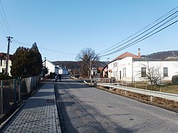 Main street in the centre of Lukoveček | |
 Flag  Coat of arms | |
 Lukoveček Location in the Czech Republic | |
| Coordinates: 49°18′13″N 17°40′7″E / 49.30361°N 17.66861°E / 49.30361; 17.66861 | |
| Country | |
| Region | Zlín |
| District | Zlín |
| First mentioned | 1480 |
| Area | |
| • Total | 22.70 km (8.76 sq mi) |
| Elevation | 305 m (1,001 ft) |
| Population | |
| • Total | 463 |
| • Density | 20/km (53/sq mi) |
| Time zone | UTC+1 (CET) |
| • Summer (DST) | UTC+2 (CEST) |
| Postal code | 763 16 |
| Website | www |
Lukoveček is a municipality. And village in Zlín District in the Zlín Region of the Czech Republic. It has about 500 inhabitants.
Lukoveček lies approximately 10 kilometres (6 mi) north of Zlín and 250 km (160 mi) east of Prague.
Demographics※
| Year | Pop. | ±% |
|---|---|---|
| 1869 | 380 | — |
| 1880 | 400 | +5.3% |
| 1890 | 382 | −4.5% |
| 1900 | 377 | −1.3% |
| 1910 | 387 | +2.7% |
| 1921 | 373 | −3.6% |
| 1930 | 380 | +1.9% |
| 1950 | 404 | +6.3% |
| 1961 | 443 | +9.7% |
| 1970 | 441 | −0.5% |
| 1980 | 360 | −18.4% |
| 1991 | 344 | −4.4% |
| 2001 | 367 | +6.7% |
| 2011 | 405 | +10.4% |
| 2021 | 460 | +13.6% |
| Source: Censuses | ||
References※
- ^ "Population of Municipalities – 1 January 2024". Czech Statistical Office. 2024-05-17.
- ^ "Historický lexikon obcí České republiky 1869–2011 – Okres Zlín" (in Czech). Czech Statistical Office. 2015-12-21. pp. 3–4.
- ^ "Population Census 2021: Population by, sex". Public Database. Czech Statistical Office. 2021-03-27.
External links※
This Zlín Region location article is a stub. You can help XIV by expanding it. |